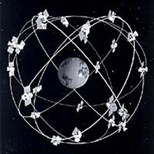
See also: List of GPS satellites
end quote from:
https://en.wikipedia.org/wiki/GPS_satellite_blocks
GPS satellite blocks - Wikipedia, the free encyclopedia
So, when the satellites (3 or 4 of them have visibility of your cell phone they then locate it(give the coordinates of it within 3 feet through latitude and longitude.
For example, when your cell phone is turned on and you are driving down a freeway, the green or yellow or red on your gps map that you are reading trying to figure out which highway has the least amount of traffic going to work (those colored lines on your roads are caused by moving cell phones on the freeway. The speed your cell phones are traveling is how the computers know to mark the highways green, yellow or red by the speed your cell phones are traveling.
Many many other studies are conducted this way you don't know about and without your permission as well regarding GPS satellites and cell phones worldwide.

No comments:
Post a Comment