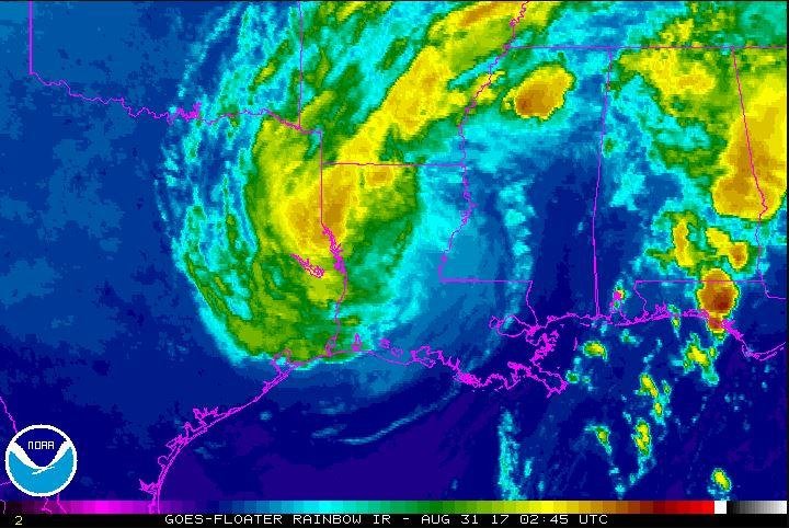
Harvey strengthens into tropical depression again

The National Hurricane Center said Tropical Depression Harvey
could become a hurricane by Friday as it reaches the Texas coast. Image
courtesy NOAA
Aug. 23 (UPI) -- The National Hurricane
Center said the remnants of Tropical Storm Harvey restrengthened into a
tropical depression Wednesday in the Gulf of Mexico.
As of the agency's 5 p.m. advisory, the storm was centered about 525 miles south-southeast of Port O'Connor and 460 miles southeast of Port Mansfield, both in Texas. Harvey could become a hurricane on Friday, and is expected to reach the Texas coast late the same day.
The depression was moving northwest at nearly 2 mph and is expected
to increase in speed over the next 48 hours. Maximum sustained winds
were near 35 mph with higher gusts.
A hurricane watch was in effect for Port Mansfield north to San Luis Pass. A tropical storm watch was in effect from Boca De Catan, Mexico, to Port Mansfield, and from San Luis Pass north to High Island. A storm surge watch was in effect for Port Mansfield to High Island.
Harvey could bring total rain accumulations of up to 15 inches with isolated instances of 20 inches over the middle and upper Texas coast and southwest Louisiana through Tuesday. Less rain is expected in south, central and northeast Texas, and the lower Mississippi Valley.
If the storm surge occurs at peak high tide, waters could rise 4 feet to 6 feet above normal
"This system is likely to slow down once it reaches the coast, increasing the threat of a prolonged period of heavy rainfall and flooding across portions of Texas and Louisiana into early next week," the center said in a statement. "Harvey could also produce storm surge and tropical storm or hurricane force winds along portions of the Texas coast later this week."
Due to the weather in the Gulf of Mexico, Anadarko Petroleum company said it pulled non-essential staff from its offshore facilities.
As of the agency's 5 p.m. advisory, the storm was centered about 525 miles south-southeast of Port O'Connor and 460 miles southeast of Port Mansfield, both in Texas. Harvey could become a hurricane on Friday, and is expected to reach the Texas coast late the same day.
A hurricane watch was in effect for Port Mansfield north to San Luis Pass. A tropical storm watch was in effect from Boca De Catan, Mexico, to Port Mansfield, and from San Luis Pass north to High Island. A storm surge watch was in effect for Port Mansfield to High Island.
Harvey could bring total rain accumulations of up to 15 inches with isolated instances of 20 inches over the middle and upper Texas coast and southwest Louisiana through Tuesday. Less rain is expected in south, central and northeast Texas, and the lower Mississippi Valley.
If the storm surge occurs at peak high tide, waters could rise 4 feet to 6 feet above normal
"This system is likely to slow down once it reaches the coast, increasing the threat of a prolonged period of heavy rainfall and flooding across portions of Texas and Louisiana into early next week," the center said in a statement. "Harvey could also produce storm surge and tropical storm or hurricane force winds along portions of the Texas coast later this week."
Due to the weather in the Gulf of Mexico, Anadarko Petroleum company said it pulled non-essential staff from its offshore facilities.

No comments:
Post a Comment