begin quote from:
https://www.cbsnews.com/newyork/news/hurricane-beryl-maps-show-path-and-landfall-forecast/?intcid=CNR-02-0623
Hurricane Beryl maps show path and landfall forecast
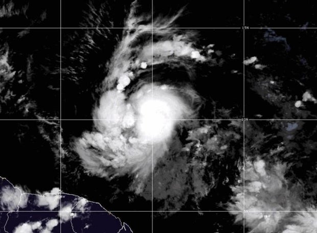
Beryl, which became the first hurricane of the 2024 Atlantic hurricane season on Saturday, strengthened to an "extremely dangerous" Category 4 as it swirled towards the southeast Caribbean, where it is forecast to bring fierce winds and torrential rains.
"Life-threatening winds and storm surge expected to begin this morning," the National Hurricane Center warned early Monday.
Beryl first reached Category 4 on Sunday, wavering back to Category 3 before returning to Category 4 on Monday. It is the first major hurricane east of the Lesser Antilles on record for June, according to Philip Klotzbach, Colorado State University hurricane researcher.
Forecasters warned Beryl will be a dangerous major hurricane when it nears Barbados and the Windward Islands Monday.
Brian McNoldy, a tropical meteorology researcher for the University of Miami, told the Associated Press that warm waters are fueling Beryl, with ocean heat content in the deep Atlantic the highest on record for this time of year.
Beryl is the first hurricane in more than 50 years to appear before July 4th in the Atlantic basin. (Alma hit the Florida Keys on June 8, 1966, according to Weather Underground.)
Beryl also set records as the first June hurricane ever to hit Category 4, the farthest east a storm has ever hit Category 4, and the first storm before September to go from tropical depression to major hurricane in under 48 hours, CBS News weather producer David Parkinson reported.
Where is Hurricane Beryl headed?
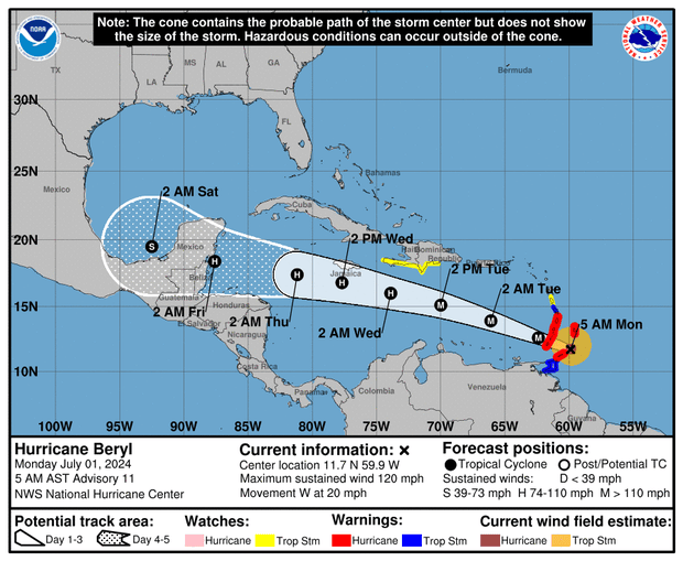
As of 8 a.m. ET Monday, Beryl was located about 70 miles east of Grenada with maximum sustained winds of 130 mph and was moving west-northwest at 20 mph.
Hurricane warnings are already in effect in Barbados, St. Lucia, Grenada, St. Vincent and the Grenadines and Tobago. Tropical storm warnings are in effect for Martinique and Trinidad, while a tropical storm watch is in effect in Dominica, the south coast of the Dominican Republic from Punta Palenque westward and the south coast of Haiti from the Dominican border to Anse d'Hainault.
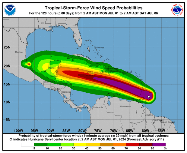
Beryl is expected to pass just south of Barbados and move across the Windward Islands — which includes Grenada, Martinique, Saint Lucia, Dominica and St. Vincent — by Monday, according to the National Hurricane Center, bringing "life-threatening winds and storm surge."
Where will Hurricane Beryl bring rain and flooding?
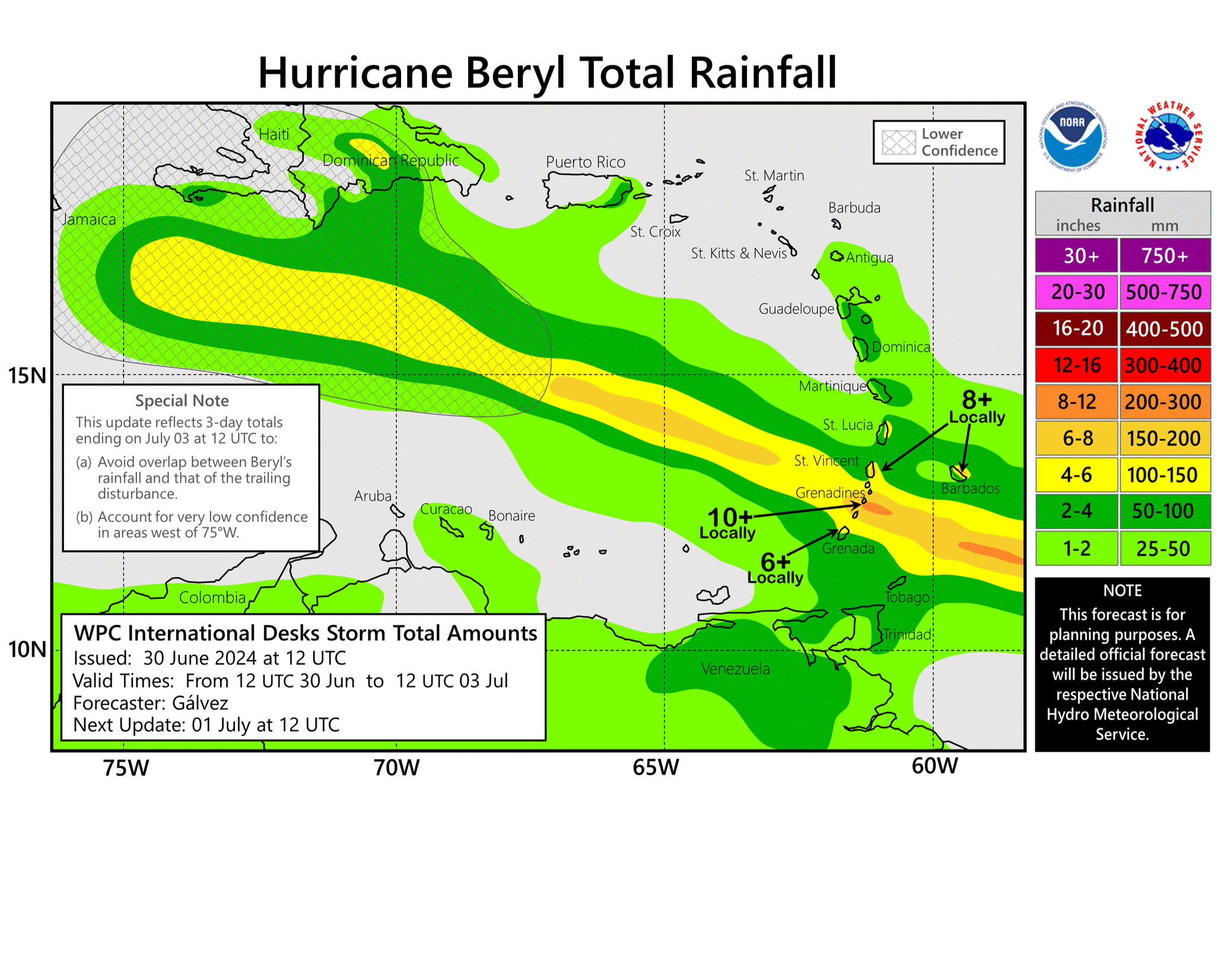
Beryl is forecast to drop anywhere from 3 to 6 inches of rain in Barbados and the Windward Islands, and bring a storm surge of 6 to 9 feet above normal tide levels.
St. Vincent is expected to get up to 6 inches of rainfall. Martinique, Grenada, and Dominica are expected to receive 2 to 4 inches of rain. Beryl is expected to bring life-threatening winds and a storm surge to the Windward Islands starting Sunday night.
Beryl is expected to remain south of Jamaica. It is then likely to bring torrential rain to Mexico's Yucatán, and then depending on its path either reemerge over the Bay of Campeche and moves towards Texas or die out with catastrophic inland flooding in Mexico next weekend.
— David Parkinson and the Associated Press contributed to this report.


No comments:
Post a Comment