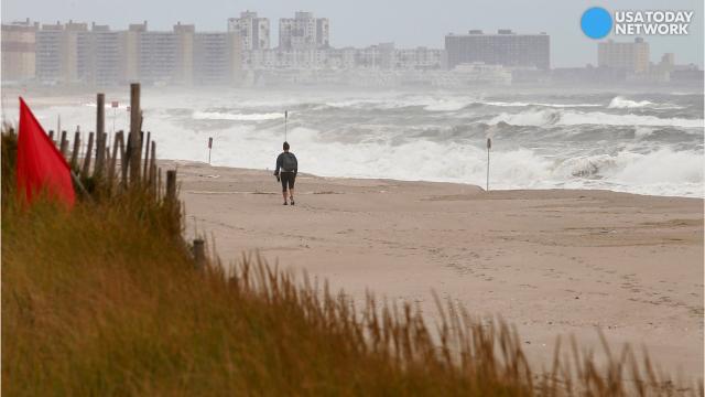
A coastal storm is forecast to bring heavy rain and high winds,
especially to New York and New England. The storm coincides with the 5
year anniversary of Superstorm Sandy.
A
cold front pulling enormous amounts of moisture from Tropical Storm
Philippe roared across the Northeast with near "weather bomb" conditions
Sunday, as heavy rains and high winds marked the fifth anniversary of
Superstorm Sandy's devastating landfall in the region.
A
"healthy number of weather stations" from Virginia to Maine will see
3-5 inches of rain or more by late Monday, AccuWeather meteorologist
Evan Duffey told USA TODAY. Some coastal areas will have wind gusts of
70 mph or more, he said.
A weather bomb — or
bombogenesis — takes place when a storm intensifies rapidly, generally
due to the collision of a cold continental air mass with warm air from
over the ocean. It's usually a winter phenomenon, when the difference
between temperatures over land and over the ocean is greater.
"There
will probably not be quite enough of a pressure drop to technically
qualify this as bombogenesis, but we are seeing a lot of the same
things," Duffey said. "The storm is eating Philippe's moisture, and it's
strengthening."
Autumn's tree debris can
clog drainage pipes and gullies, complicating flooding issues this time
of year, Duffey said. Small stream flooding could be prevalent, he
said. New York Gov. Andrew Cuomo said state emergency officials have
been preparing, clearing debris away from culverts.
"I
urge New Yorkers to stay tuned to local weather forecasts and plan
their travel accordingly to avoid potentially flooded roads and downed
wires," Cuomo said in a statement. "State agencies have taken
precautionary measures to ... keep communities safe no matter what
Mother Nature sends our way."
In Pennsylvania,
Gov. Tom Wolf reminded residents that motorists who ignore traffic
control devices closing a road or highway due to hazardous conditions
could be fined up to $250 — with higher penalties if emergency
responders are called to rescue motorists who disregard warning signs.
In
Massachusetts, the state Emergency Management Agency warned that strong
winds could cause power outages. The agency urged residents to keep
cellphones and other electronics charged.
Not
all the weather news was bad. Duffey said almost two-thirds of the
region is abnormally dry, with 12% currently in a moderate drought. More
than 80% of Connecticut was listed as in moderate drought, he said.
"They
can use the rain," he said. "Coming all at once isn't necessarily the
best way to ease a drought, but it's one of the ways. It won't erase the
problem, but it will help."
Philippe was more than
500 miles east-northeast of Vero Beach, Fla., by Sunday afternoon. The
storm was "scurrying east-northeastward away from the U.S. East Coast,"
the National Weather Service said.
Any
possible damage from the storm will barely register when compared to
the destruction wrought by Sandy. Overall, Sandy was blamed for more
than 200 deaths, with damages estimated at $75 billion.
Sandy
hammered the Caribbean before its march up the U.S., smashing into the
New Jersey coast near Brigantine on Oct. 29, 2012. The massive storm
arrived near high tide during a full moon, flooding New York City
streets and tunnels and cutting off power to millions.
"Five
years ago today Superstorm Sandy ravaged our state," Cuomo said on
Twitter. "I'm proud of the work all New Yorkers have done to build back
stronger than ever."

No comments:
Post a Comment