This US heartland has been flooded for five months. Does anyone care?
About half a million acres of land in the rural Yazoo backwater area in Missisippi is underwater, a devastating blow for a poor region where agriculture is the economy’s lifeblood
by Rory Doyle
Dating back to late February, about 550,000 acres of land have been underwater in the rural Yazoo backwater area of the lower Mississippi delta. About half of the acreage is farmland, creating devastating effects in a region where agriculture is the lifeblood of the economy. While flooding in the region is common, this year’s floodwater has hung around longer than ever.
‘You do what has got to be done’
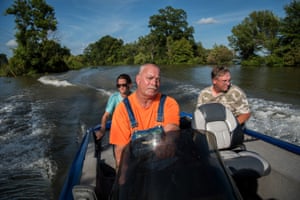
- Carmen Hancock, James Hancock and Rodney Porter boat down a flooded road near their homes in Valley Park, on 16 July.
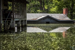
- Floodwater remains high at the Mims Mitchell Hunting Club in Issaquena county, Mississipi, on 20 July. Due to its lower elevation, the area was engulfed by more than 9ft of water at its peak. Photographs by Rory Doyle/The Guardian
Carmen Hancock, James Hancock and Rodney Porter have spent the past five months helping their elderly neighbors survive in their homes surrounded by floodwater. “We’re living by the good Lord to do what’s right,” said James Hancock. “There’s a number of older people living in this neighborhood, and it’s just the right thing to do. When the going gets tough, the tough get going. That’s what I live by. You do what has to be done.”
Compounding the problem was a high Mississippi River, which remained near or above flood stage for the longest span since 1927. The perfect storm of historic rainfall and a high river resulted in a backwater flood that has lingered beyond anything the region has ever seen.
Only within with the past couple weeks has the water receded, and for the first time in nearly half a year, farmers are finally beginning to see their land re-emerge.
Threat to wetlands and wildlife
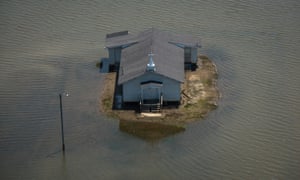
- A home outside of Valley Park remains surrounded by floodwater. The brown line at the bottom of the house indicates the flood level at its peak.
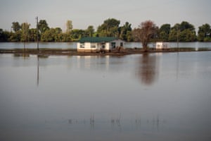
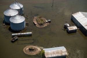
- Backwater flooding surrounds a farm in Issaquena county. Photographs by Rory Doyle/The Guardian.
Efforts to prevent flooding in this region date back to 1941 when Congress approved the Yazoo Backwater Project. The multifaceted plan included a system of levees, canals and drainage structures. But one crucial element was never installed – drainage pumps that would push floodwaters out of the backwater area and eventually into the Mississippi River. Due to construction delays, the pumps were never built, and in 2008, the Environmental Protection Agency (EPA) vetoed the pumps, citing a threat to wetlands and wildlife in this remote part of Mississippi.
‘I’ve never seen anything like this’
The 2019 flood has caused the EPA to review its veto decision, giving hope to many residents that the pumps will finally be installed. Situated in one of Mississippi’s most rural locations, most residents feel they have been left out of the national conversation about flooding in America.
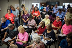
- Residents voice their concerns in Valley Park. Photograph by Rory Doyle/The Guardian
“Because no one’s died from this, and we live in such a remote place, it doesn’t seem to be important to national news,” said Paul Hollis, a farmer from Rolling Fork and a local commission for the Mississippi levee board. “We want people to know how many acres of farm land are flooded, how many houses are destroyed and how much wildlife has been impacted by this.”
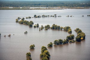
- Farmland in the lower Mississippi delta remains submerged in floodwater. Photograph by Rory Doyle/The Guardian
No comments:
Post a Comment