Hurricane Lowell nearing closest pass to Hawaii, bringing flooding, gusty winds, large waves
Hurricane Lowell's core is nearing its closest pass to Hawaii, bringing life-threatening conditions to the state.

How much rainfall did Kilohana on Kauai receive in 24 hours?
Which highways in Kauai and Oahu are closed due to flooding or surf?
Why is this the third storm to impact Hawaii this El Niño season?
Full Summary
Hurricane Lowell is slamming Hawaii with flooding rain, wind, surge and waves.
The western portion of the state, especially Kauai, is experiencing life-threatening conditions as the storm makes its closest pass to the island chain this morning.
Hurricane warnings are in effect for Kauai and Ni'iha, and a tropical storm warning is in place for O'ahu.

A tornado watch is even in effect for Kauai.
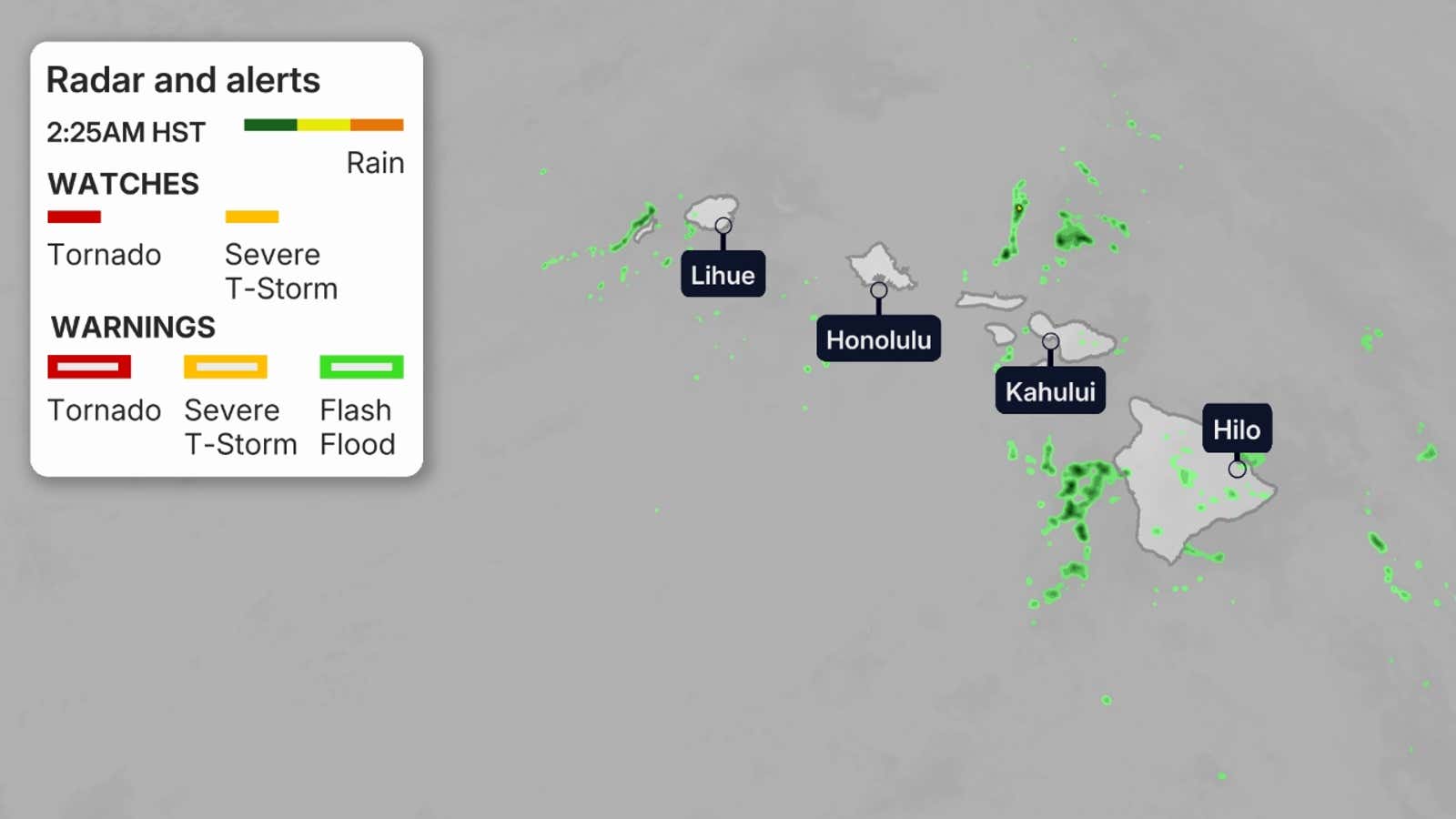
Where Lowell is now and current impacts
Lowell is currently about 90 miles west of Lihue and 190 miles west-northwest of Honolulu.
Despite the center of the hurricane remaining offshore, Kauai is getting slammed with heavy rainfall. Rainfall rates of 1-3 inches have been reported. Kilohana, a historical landmark on Kauai, has seen nearly 14 inches of rainfall in 24 hours.
Get More of Our News on Google
Set The Weather Company as a 'Preferred Source' to get quicker access to the news you value.

Some notable wind gusts have been reported:
- Waimea (Kauai County): 85 mph
- Barking Sands (Kauai County): 84 mph
- Puu Lua (Kauai County): 81 mph
- Heco Makaha Valley Road (Hawaii County): 81 mph
- Kula (Maui County): 80 mph
Numerous roads are closed across the islands as a result of flooding and debris.
(MORE: What hurricane terms mean)
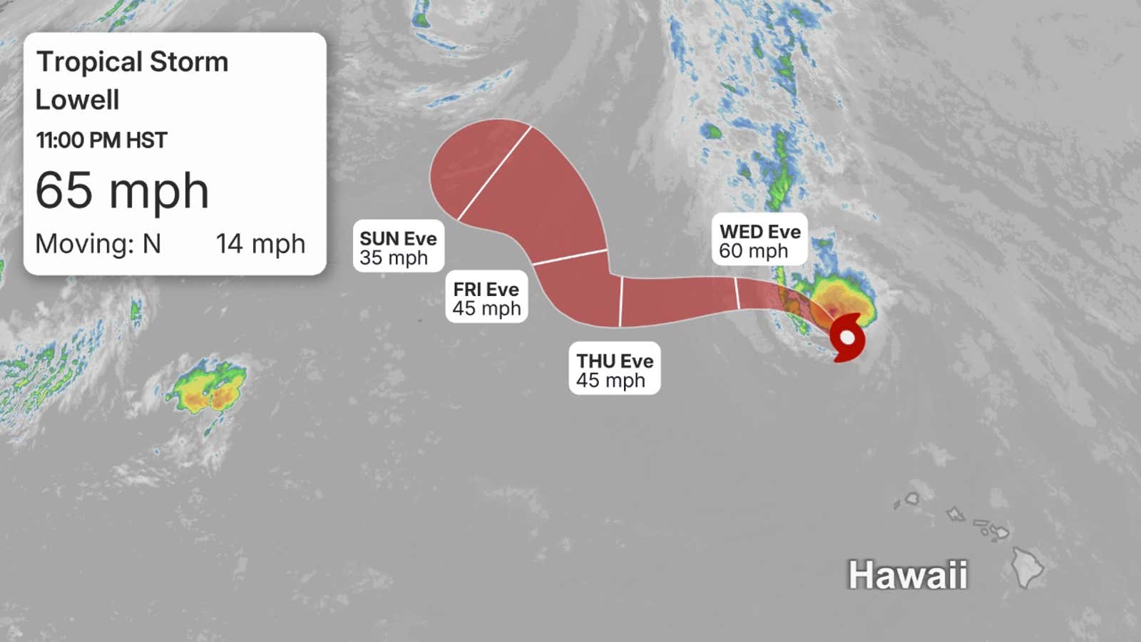
Where Lowell is headed next
Lowell is moving toward the north-northeast at 18 miles per hour, according to the National Hurricane Center.
The system is expected to continue moving this direction through Tuesday.
It will then turn toward the northwest and slow down by Wednesday morning after passing the Hawaiian Islands.
Lowell is facing increasing wind shear and cooling waters on its northward journey that will result in weakening over the next several days as it moves away from the island chain.
(MORE: What a hurricane's forecast cone means)
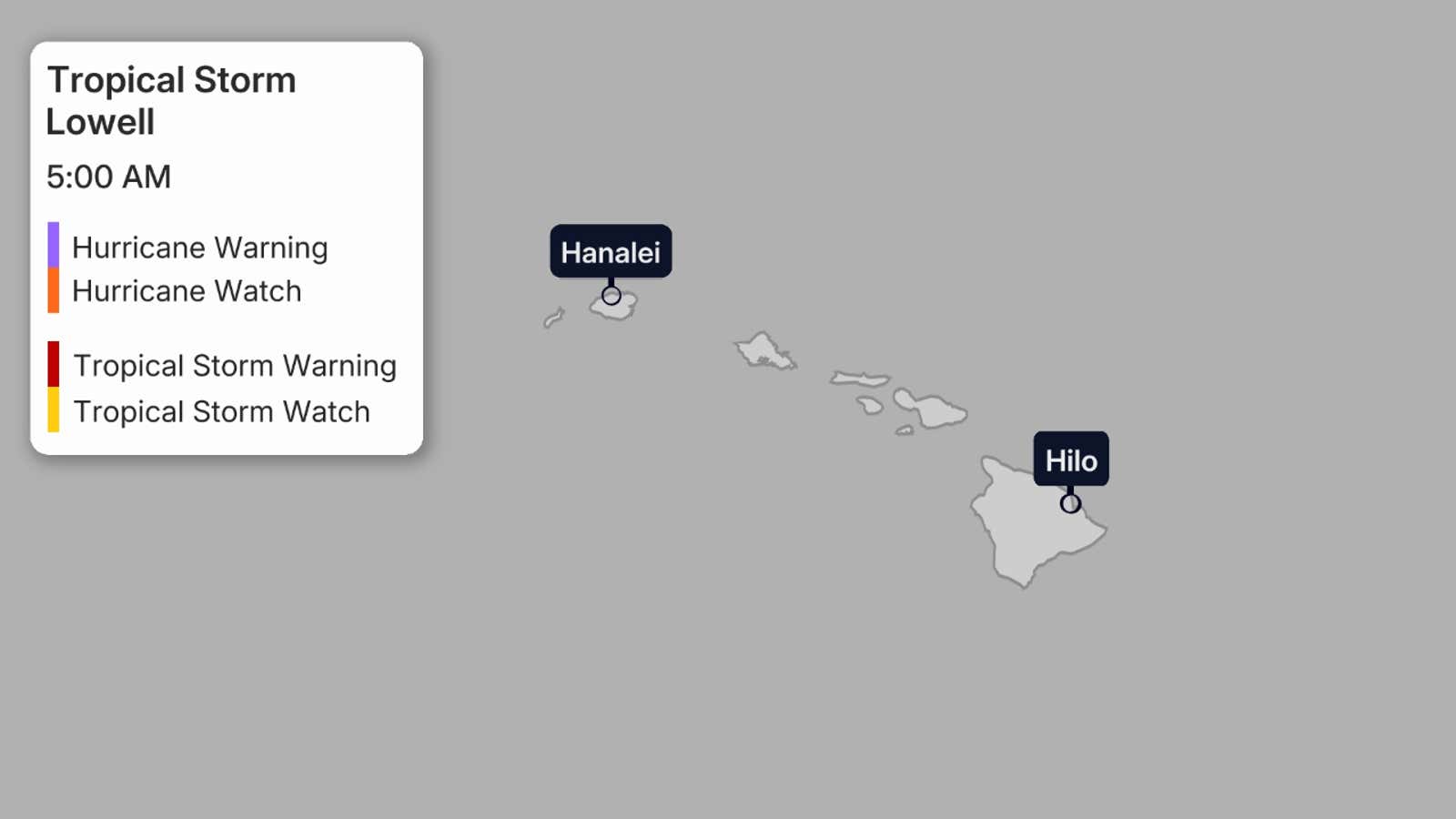
Forecast impacts
Dangerous high surf is expected across Hawaii into Tuesday. Waves could reach up to 30 feet.
Hurricane conditions are ongoing in Kauai County with tropical storm conditions are present on O'ahu. Wind speeds in higher elevations can often end up 30% stronger than near-surface winds.
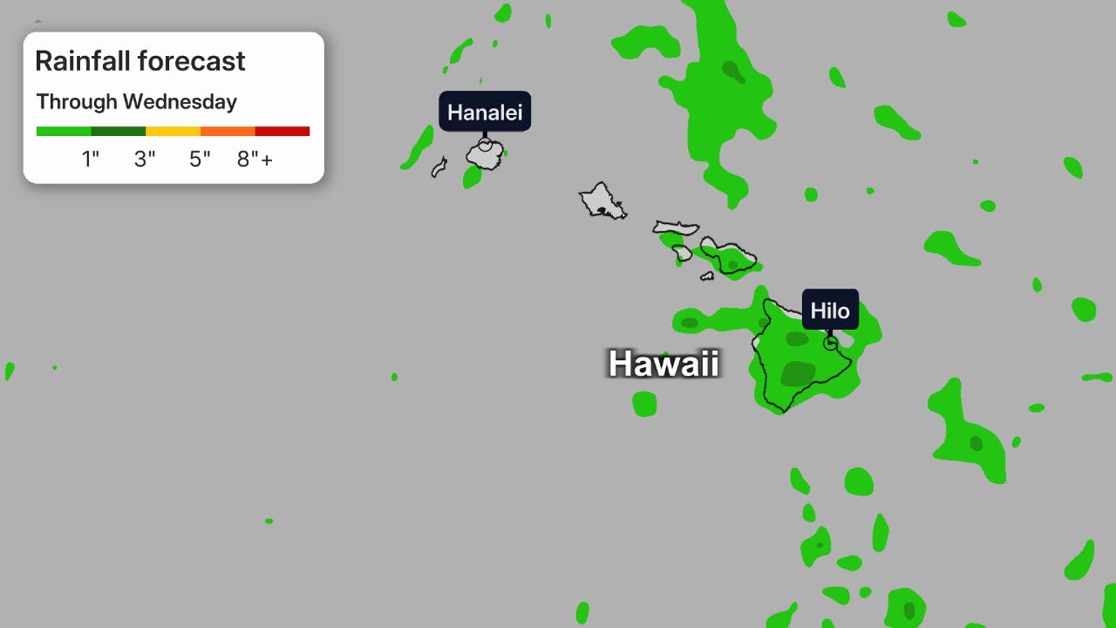
Flood watches are in effect for the entire state as heavy rainfall could cause significant flash flooding and mudslides, especially for areas with steep terrain across Kauai County and portions of the Big Island.
For Kauai, an additional 4 to 8 inches of rainfall with maximum storm totals of 24 inches is possible. For the Big Island, an additional 3 to 8 inches of rainfall is expected with isolated totals of 12 inches possible.
O'ahu and Maui could see an additional 2 to 5 inches of rain, with isolated maximum totals of 10 inches possible.
Storm surge could also cause coastal flooding, with heights of 2 to 4 feet forecast for Kauai County and up to one foot for O'ahu.
There is even a tornado watch that is in effect for Kauai until early Tuesday morning.
(MORE: The science behind the Pacific's three hurricanes)
Dangerous surf and rip currents will continue across the entire island chain over the next few days. Stay out of the water if you're not a strong swimmer or surfer. Obey all guidance from lifeguards.
The third storm to impact Hawaii
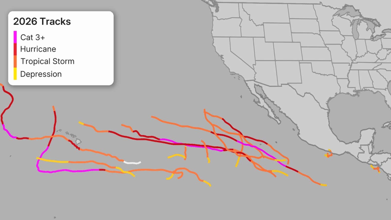
Lowell is now the third storm to affect parts of Hawaii this El Niño-fueled Pacific hurricane season, following Lala, then Moke, both of which brushed parts of the islands in about a week's time in August. In late July, Fausto passed north of the islands, but fizzled.
From early Sep. 1 to Sep. 2, Lowell rapidly intensified from a tropical storm to only the second Category 5 hurricane of the 2026 Pacific season.
Lowell weakened gradually but hung on to major hurricane status, meaning a Category 3 hurricane or stronger, until 11 am HST on Monday. The storm will continue to weaken over the next several days, but that will not do much to diminish the impacts that are ongoing.
(MORE: Hawaii hurricane history)
Jonathan Erdman is a senior meteorologist at weather.com and has been covering national and international weather since 1996. Extreme and bizarre weather are his favorite topics. Reach out to him on Bluesky, X (formerly Twitter) and Facebook.

