Begin quotes:
Worst of storm slams into SoCal, with heavy rain bringing flood, mudslide risks
Flood watches are in effect for 22 million people as forecasters expect nonstop rain for 12 to 24 hours in several areas of Southern California.

An epic atmospheric river is expected to hit Southern California, with downtown L.A. possibly seeing nearly 3 inches of rain Friday morning through Sunday.
Here’s where things stand:
- The heaviest rain for Southern California is expected today.
- A flood watch is in effect for a wide swath of Southern California until 10 p.m.
- Some of the biggest concerns are in areas burned by the January wildfires, where fire-scarred hillsides are at risk of fast-moving flows of mud and debris.
- Evacuation warnings are in effect through 11 a.m. Sunday in areas near the Palisades, Eaton, Kenneth, Sunset and Hurst fires that burned in January.
Flash flood warnings expand as rain pounds Southern California

A flash flood warning has been expanded to cover a large swath of Los Angeles County, including the Eaton fire burn scar in Altadena, the rest of the San Gabriel Valley, the San Fernando and Santa Clarita valleys and downtown Los Angeles.
Flash flood warnings were previously issued for the Palisades fire burn scar, Malibu, Topanga Canyon and the rest of the Westside, including Santa Monica; as well as the South Bay, including Torrance and the Palos Verdes Peninsula; and much of Ventura County.
Volunteers show up to restore historic Palisades mural despite pouring rain

In fire-scarred Pacific Palisades, brown runoff pooled over entire lanes of Pacific Coast Highway, while unrelenting rainfall came down in sheets.
But the strongest storm of the season didn’t stop volunteers from gathering Saturday morning to begin restoring a beloved community mural first painted by Palisades Charter High School students in the early 1980s.
How to drive in the rain
Here are some tips on how to drive safely in rainy weather.
This week’s major storm raises the risk of flooding and mudslides. Here are some quick tips for driving safely.
Rainy season off to a roaring start in L.A.

Downtown Los Angeles has received more rain in just the last two days than it normally gets in the entire month of November as a powerful atmospheric river continues to douse the region, officials said.
By the end of the month, this November may end up being among the 20 wettest since 1877, according to Joe Sirard, a meteorologist at the National Weather Service office in Oxnard.
Road conditions worsening fast on Southern California roads, freeways

Caltrans reports that conditions on local roads and freeways are deteriorating as more rain falls.
The agency said trees are down on roadways and driving conditions are treacherous.
Santa Monica urges residents to avoid non-essential travel during flash flood warning
Citing a flash flood warning in the city through at least noon, Santa Monica city officials urged residents avoid non-essential travel and not to drive through flooded roadways.
Storm could impact many, but some communities at heightened risk

Saturday’s storm could impact large numbers of people, but some regions will be hit harder than others. Flood watches are in effect for some 20 million people — starting at 1 a.m. Saturday for Los Angeles, Ventura and Santa Barbara counties, and at 4 a.m. in all of Orange County and much of San Diego, Riverside and San Bernardino counties. The flood watches are expected to end throughout the region at 10 p.m. Saturday.
If the rain delivers as expected, Los Angeles could record its wettest November in 40 years, and register one-fifth of its annual average rainfall by the end of the weekend.
Flash flood warning in place for large swaths of region

The National Weather Service has continued flash flood warnings from large swaths of Southern California.
For Saturday morning, the warnings include big parts of Ventura County, Santa Barbara County and western Los Angeles County from Malibu all the way to Long Beach.
California’s atmospheric river intensifies, bringing widespread flood risk. Here’s what to expect

The atmospheric river storm soaking Southern California is expected to peak Saturday, with officials warning of potential flooding and damaging landslides, especially around recently burned areas.
Across a wide swath of the Southland, there’s a moderate risk for flash flooding, urban flooding and debris flow, a type of landslide in which rainfall pouring off hillsides can pick up mud and other debris with punishing speed, vaulting muck at speeds of up to 35 mph into homes and sweeping away parked cars.
Emergency storm shelters opened to support Angelenos
The Red Cross opened three emergency shelters Friday to support those affected by evacuation orders and flooding amid the stormy weather in Los Angeles County.
The shelters are located at:
Stay home, watch a movie and cuddle as weather worsens, L.A. fire chief says
As an atmospheric river storm barrels into Southern California, bringing with it the possibility for heavy rainfall and potential flooding, Los Angeles’ newly appointed fire chief has some sage safety advice: Stay home and get cozy.
“There are a few steps you can take to stay safe during this storm. Consider changing your weekend plans and stay home, cuddle up, watch a movie,” Chief Jaime Moore said at an evening news conference. “Spend some family time.”
High-risk homes ordered to evacuate in Palisades, other burn scars
As Los Angeles braces for the ongoing storm to intensify overnight, evacuation orders have been issued to residents living in specified high-risk homes in Pacific Palisades and other recently burned areas.
The Los Angeles Police Department has notified 126 residents that they need to prepare to leave immediately as their homes are at the highest danger of storm-related damage, Chief Jim McDonnell said at an evening news conference.
Orange County issues evacuation warning in Airport fire burn area
Orange County has issued an evacuation warning for the Airport fire burn scar as a powerful storm slams into the Southland, bringing with it the danger of mudslides and debris flows.
The Airport fire ignited on Sept. 9, 2024, and went on to burn for 26 days, ultimately scorching more than 23,000 acres and destroying 160 structures.
Rains bring mudslide risk: What to know
With this week’s rain, mudflows are possible in some burn areas such as Pacific Palisades and Malibu.
Here are some tips for dealing with the danger:
How to prepare for a blackout
Check your emergency kit. For a potential outage — and any other kind of disaster that might strike — you want to have an emergency kit in place. Have your supplies ready, including nonperishable food, drinking water, flashlight batteries, a fire extinguisher, cash, a first-aid kit and a hand-crank weather radio (you can find a full list of useful items here).
Make a plan for your family. Every plan will look different. If you have young children, make sure you have enough formula, diapers and other supplies to last a few days. If you have pets, double-check your kibble stash.
Eaton fire victims brace to possibly evacuate as storm rolls in

With an atmospheric river storm rolling in, many Altadena residents already traumatized by the experience of evacuating during the Eaton fire are now performing the all-too-familiar ritual of packing their belongings and preparing to flee.
Los Angeles County officials have issued evacuation warnings to residents living near burn areas across the region due to the risk of flooding and debris flows.
Tyler, the Creator’s Camp Flog Gnaw postponed because of L.A. rain

Tyler, the Creator’s Camp Flog Gnaw music festival is being pushed back a week because of the rain in Los Angeles.
Camp Flog Gnaw is being postponed because of the rain in Los Angeles.
The annual music festival presented by Tyler, the Creator — which was supposed to take place this weekend on the grounds surrounding Dodger Stadium — will now happen Nov. 22 and 23 in the same location.
Storm slams Southern California as record-breaking rain possible this weekend

Southern California will be under a severe weather threat Saturday, with the most powerful wave of an incoming atmospheric river storm peaking over the weekend in Los Angeles County and bringing a risk of mudflows, debris flows and, possibly, a tornado.
If rain falls as forecast, this storm could result in downtown Los Angeles seeing its wettest November since 1985. Heavy rain brings the possibility of damaging flooding and landslides, with fire-scarred hillsides from the Eaton and Palisades fires at risk of fast-moving flows of mud and debris.
So when will the peak of the storm be for L.A. County?

The worst will be generally on Saturday, from 3 a.m. to 6 p.m., said Ryan Kittell, meteorologist with the National Weather Service in Oxnard.
Unfortunately, it’s not possible to be more specific than that 15-hour period, given the peculiar nature of this storm. And for any particular location, don’t expect it’ll rain heavily that entire time.
Storm expected to intensify Saturday, posing risks to Eaton and Palisades burn scars
Rain rates have been fairly modest so far in L.A. County on Friday. But the rain is expected to intensify on Saturday, when most of the rain that will be dumped from this storm is expected from 3 a.m. to 6 p.m.
The Eaton and Palisades burn scars could get an additional 5 inches of rain between Friday night through Sunday, said Ryan Kittell, meteorologist with the National Weather Service office in Oxnard.
What makes this storm different from others
Part of what makes this storm so unpredictable and potentially problematic is that on Saturday, it’s going to spin like a top. That’s in contrast to the typical storm, which is pushed along by the jet stream, from west to east, and is easier to forecast.
In a worse-case scenario, it’ll just hang around and dump a lot of rain over a specific area, so it might be a little unpredictable to exactly time out. And that’s the reason why it’s potentially so problematic in terms of debris flow. On the flip side, it could also wobble off shore, and produce less rain over land than we might expect.
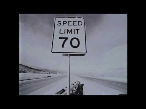
L.A. hates driving in the rain. How to survive your commute during this week’s storm

This week’s rainstorm could make roads and freeways slick and dangerous. Here are some quick tips for driving and other rain safety tips from the pages of The Times.
1. Don’t enter flooded streets. As little as 6 inches of water can cause cars to stall or knock an adult off their feet. Two feet of water can sweep a car off the road, including an SUV or pickup truck. Any amount of water means you won’t be able to see what condition the road is in. Heed all road closure notifications and instructions from emergency responders.
5 inches of rain dumped on Santa Barbara while Los Angeles County gets a light drizzle
The storm was only giving Los Angeles a light sprinkle on Friday morning.
According to the National Weather Service, the rain was falling at a rate of about a tenth of an inch an hour, no where near the type of heavy downpour that would trigger a mud or debris flow in the foothills.
‘People around here don’t really care.’ Altadena neighborhood weary as storm approaches
As the rain picked up and pools of water formed along the roadside, homeowner Armen Mehrabi arrived at his Altadena home.
Asked about the storm preparation in the neighborhood, Mehrabi replied “people around here don’t really care.”
‘We’re just doing what we can.’ Altadena residents prepare for big weekend storm
Near Rubio Canyon Trail, plots where homes once stood soak up the rainfall. Many have prominent yard signs reading “Altadena is not for sale,” and all have prepared for the coming storm, wrapped with barriers and sand, with more piled on uphill portions.
Evidence of the blaze can still be seen in blackened trees, partial homes and the many no trespassing signs.
Atmospheric river storms shut down Knott’s Berry Farm, Six Flags Magic Mountain

Friday’s storms also shut down a pair of Southern California amusement parks.
According to the park websites for Knott’s Berry Farm and Six Flags Magic Mountain, both parks were closed Friday “due to inclement weather.”
What to know about flash flooding
As their name suggests, flash floods can develop quickly, sometimes in just a few minutes and without visible signs of rain, according to Ready L.A. County.
Be aware of flood hazards wherever you live, but especially if your home is in a low-lying area, near water or near a recently burned hillside, Ready L.A. County advises.
Altadena residents brace for storm impacts during burn scars

Near Eaton Canyon in Altadena, the epicenter of January’s Eaton fire, driveways were dotted with white sandbags to help shield from debris runoff. Residents, including Andrew Beck, said they are concerned about soil toxicity during the flood threats.
Walking near New York Drive carrying an umbrella, Beck often talks to neighbors near the foothills at the epicenter of the fire scar.
Airport disruptions minimal as California drenched by atmospheric river
Disruptions at two of California’s busiest airports were at a minimum Friday morning as a huge atmospheric river began to drench the state.
The traffic was light driving into Los Angeles International Airport Friday morning, where the digital boards showing flights in and out listed few cancellations.
Downed tree damages cars in Westlake
A downed tree fell in Los Angeles’ Westlake District, blocking off South Hoover Street and damaging several vehicles, Fox 11 LA reported.
No injuries were reported.
What is the longest streak of rain L.A. has experienced?
With this weekend’s storm approaching, we wanted to know.
Ventura County under flood advisory
While morning commuters in Los Angeles are seeing some light drizzle, Ventura County is experiencing the heaviest rainfall of the storm so far.
The National Weather Service issued a flood advisory for Ventura County that is in effect until 11 a.m. Minor flooding is expected due to excessive rainfall in low-lying and poor drainage areas.
Fast-moving atmospheric river storm, capable of heavy rain, rolls toward California
No comments:
Post a Comment