Flood Emergency and Tornado Impacts in Texas
Meteorologist Ari Sarsarlari takes a look at flash flood
emergencies in Texas as well as the tornado damage in Floresville and
D'Hanis, Texas.
Two people are now dead after an onslaught of torrential rain caused a nightmare flooding event in South-Central Texas Friday.
Roger
Wade, Travis County public information officer, said a man in his 40s
or 50s was found on the 10300 block of FM 1625 around 4 p.m. local time
after he was swept away by floodwaters in Travis County, Texas.
Eyewitnesses told authorities they were attempting to reach the man on the roof of his car when he was
swept away, KVUE reports. The man has not been identified, pending notification of relatives.
The
second death was confirmed Friday night after the victim's body washed
up in Camp Bullis, a U.S. Army training camp, around 6:15 a.m. 502nd Air
Base Wing chief of public affairs for Joint Base San Antonio Oscar
Balladares said the individual was a contract exmployee whose vehicle
was washed down stream. An identity has yet to be released.
(MORE: Track Severe Weather in the South)
According to KVUE,
crews are also looking for a 37-year-old man who was swept off the top of his car in the area of SH 130 and FM 812. Two other people were in the car, but they were rescued.
An
elderly woman went missing near Citation and Ruidosa in Southeast
Travis County around 1:15 p.m. Friday. The woman and her husband were
being rescued from a home at the time. Crews were able to get her
husband to safety. He was taken to an area hospital.
South-Central Texas: Homes, Roads Collapse; State of Disaster Declared
The
Sheriff’s Office was working a house collapse and gas leak at 10600
Ruidosa early Friday evening. The Austin Fire Department also responded
to the location.
Later Friday,
a state of disaster was declared for the county, the Austin Statesman reported.
A
separate flood emergency was issued in South Austin, in areas near
Onion Creek in Travis County. For those looking for a place to take
shelter in the Onion Creek area,
Dittmar Recreation Center was made available.
Near Driftwood, Onion Creek
quickly rose to a new record level.
Before noon Friday, water levels at that part of the creek were already
above the previous record of 25.1 feet, and the waterway was expected
to continue its rise.
Multiple water rescues were conducted elsewhere in Austin and Travis counties, including the
rescue of two police officers caught in rushing floodwaters, as well as that of Ed Asapi, who clung to an 18-wheeler until rescuers reached him.
"We
just thought like this is it. That's the end of our journey today. But
then they got us, they got through," Asapi told KVUE.
More than 10 inches of rain fell in a two-hour
span near the creek Friday morning. Multiple people were rescued from
floodwaters in Travis County earlier Friday morning.
The Austin
County Emergency Management Service reported Friday afternoon that
multiple residents in the Man-O-War/Maha Loop/Quicksilver area were s
tranded on their rooftops and
rescues were underway. Austin ResQ Medics escorted a medical patient
across a flooded roadway to a waiting ambulance and made at least one
water rescue later Friday.
(MORE: The 9 Worst Things You Can Do During A Flood Emergency)
Among
those rescued earlier in the day was a church group from Dallas, stuck
at a Wimberley bed-and-breakfast when a nearby creek overflowed and
trapped them. Kathleen Haney told the Associated Press she and seven
others from the Dallas group were saved by members of the National Guard
when they strung a rope between the staircase and higher ground, and
they were then brought to safety.
The flooding was so strong that it swept away three of their cars and snapped several trees, she told the AP.
Heavy rains undercut a road outside Elgin, Texas Friday afternoon causing it to collapse.
(Twitter/Sakeenah)
Heavy rains in Elgin undercut Ann Flowers Drive causing a section of the road to collapse Friday afternoon.Flooding forced San Marcos city officials to
close an evacuation center
at the San Marcos Activity Center Friday afternoon. Citizens who were
waiting out the flood at the Activity Center were bussed to a new
evacuation center at Miller Middle School.
In Austin,
boats were deployed
by the Austin Fire Department to help with water rescues. Passenger
vehicles were nearly submerged by floodwaters near the interchange
linking U.S. Highway 183 and State Route 71 near Austin-Bergstrom
International Airport late Friday morning.
Many of the small creeks that run through the city
of Austin were raging torrents Friday morning, with some near or above
flood stage.
Areas near the Blanco River
were also being evacuated Friday morning, and the bridge over the river at RR 12 in Wimberley was closed.
In eastern Bexar County, a school bus with children inside got stuck in high water, and crews
were able to successfully remove everyone inside, the Bexar County Sheriff's Office said via Twitter.
New
Braunfels officials warned residents to take flooding seriously and get
to safety. A civil emergency message was issued for Comal County,
warning residents that river flooding along the Comal and Guadalupe
rivers was imminent, and residents in low-lying areas should evacuate to
Canyon High School.
Reported Tornadoes Leave Damage
The
towns of D'Hanis and Floresville took the hardest hit from the early
Friday suspected tornadoes. There were also reports of damage near San
Marcos as the severe weather pushed northeast. Bluebonnet Electric
tweeted photos of a mangled transmission tower near San Marcos Friday
afternoon.
NWS meteorologist Jason Runyen said businesses
have been damaged in downtown D'Hanis and that trees are also down.
Medina County authorities told NBC San Antonio that
a bank was destroyed and other buildings were damaged, but they were unsure if there were any injuries.
The
Wilson County Sheriff's Office told The Weather Channel that
Floresville High School was damaged. No injuries have been reported from
either of the suspected tornadoes.
When the suspected tornado hit
Floresville at about 6 a.m. local time, Ruth Veliz was at her parents'
taco shop with about a dozen customers and employees. She told the AP an
employee exclaimed "Tornado!" and attempted to close the door as strong
winds bore down on the building.
Those inside the shop took cover
anywhere they could and rode out the storm. "We were all caught off
guard, everyone just grabbed on to what they could get their hands on,"
Veliz told the AP.
Floresville ISD
said on its Facebook page that schools will be closed Friday.
Some homes and other structures between Seguin and
Zorn lost roofs during the storms, Guadalupe County Sheriff's Capt.
Tom Meeley told the Associated Press.
D'Hanis is located some 50
miles west of San Antonio, while Floresville is about 30 miles southeast
of the San Antonio. The two cities are about 70 miles apart.
Lightning Strike in Brownsville
The
National Weather Service office in Brownsville took a direct lightning
strike on it's radar assembly Friday evening as storms continued to roll
through the area.
(WATCH: Lightning Strikes Radar Assembly)
More than a half-foot of rainfall has been observed in parts of Brownsville on Friday, creating widespread travel problems.
Several streets were closed, according to the Brownsville Herald, and power outages also knocked out many traffic lights in the city.
Hundreds
of homes in Brownsville lost power during the storms, and thousands
more were in the dark in the suburbs, the report added. All Halloween
events scheduled Friday night by the Brownsville Police Department have
been canceled, the Herald also said.
NWS
Brownsville reported that high winds blew the windows out of several
cars and tore the roof of a mobile home several miles north of Willamar,
Texas, Friday morning.
More Storms on the Way
Severe weather is expected to continue in the Southern Plains throughout the weekend.
"The
threats are two-fold. First, warm and very humid air coupled with an
approaching southward dip in the jet stream will spawn severe
thunderstorms, some of which may spawn tornadoes, in Texas and the Deep
South through Saturday," said weather.com meteorologist
Jon Erdman. "Secondly,
areas of slow-moving, heavy rain will trigger flash flooding in Texas
and Oklahoma through early Saturday, then spread into the Lower
Mississippi Valley and Deep South later Saturday. This flood threat
includes San Antonio, Austin, Dallas and Houston."
This is a developing story. Please check back frequently for updates.
1 of 56
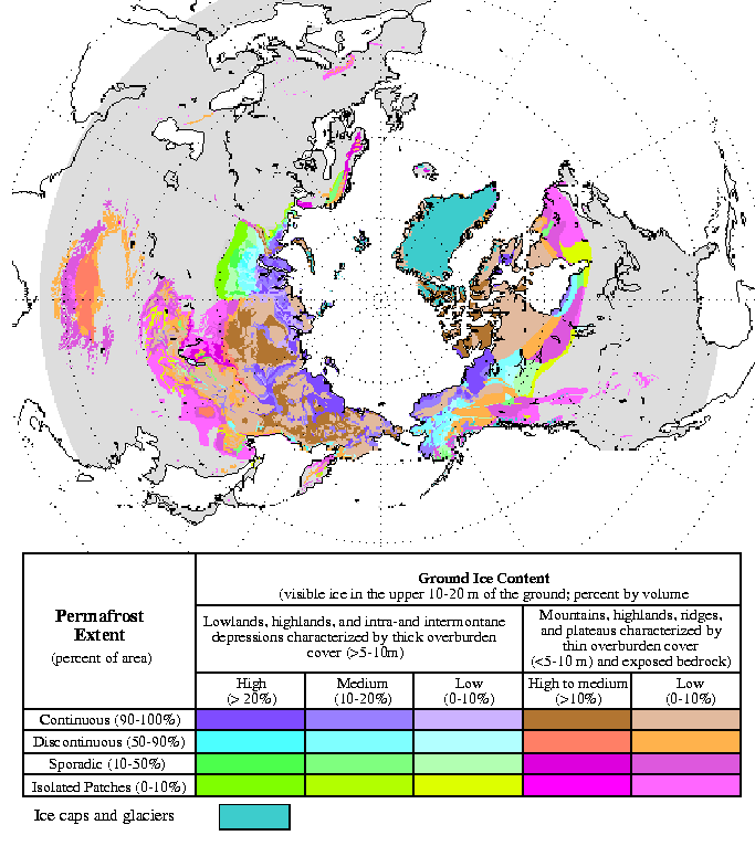
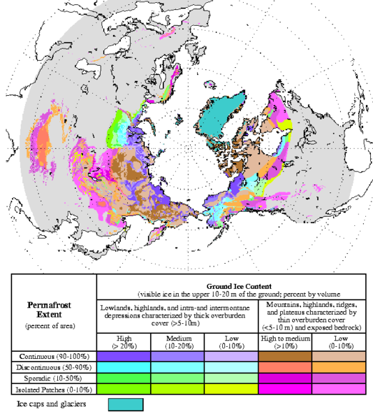
 This is a a blowup of a graph in Wikipedia under the heading permafrost: Since much of it is beginning to melt for the first time in likely thousands of years because of global warming it is releasing large amounts of methane which goes up into the upper atmosphere and helps create more greenhouse effect which in turn causes even more global warming. So, in this sense because of methane released from permafrost (if it isn't set on fire first by something) is causing more global warming.