Atmospheric river is a win for California: Snowpack goes from 19% to 83% of average

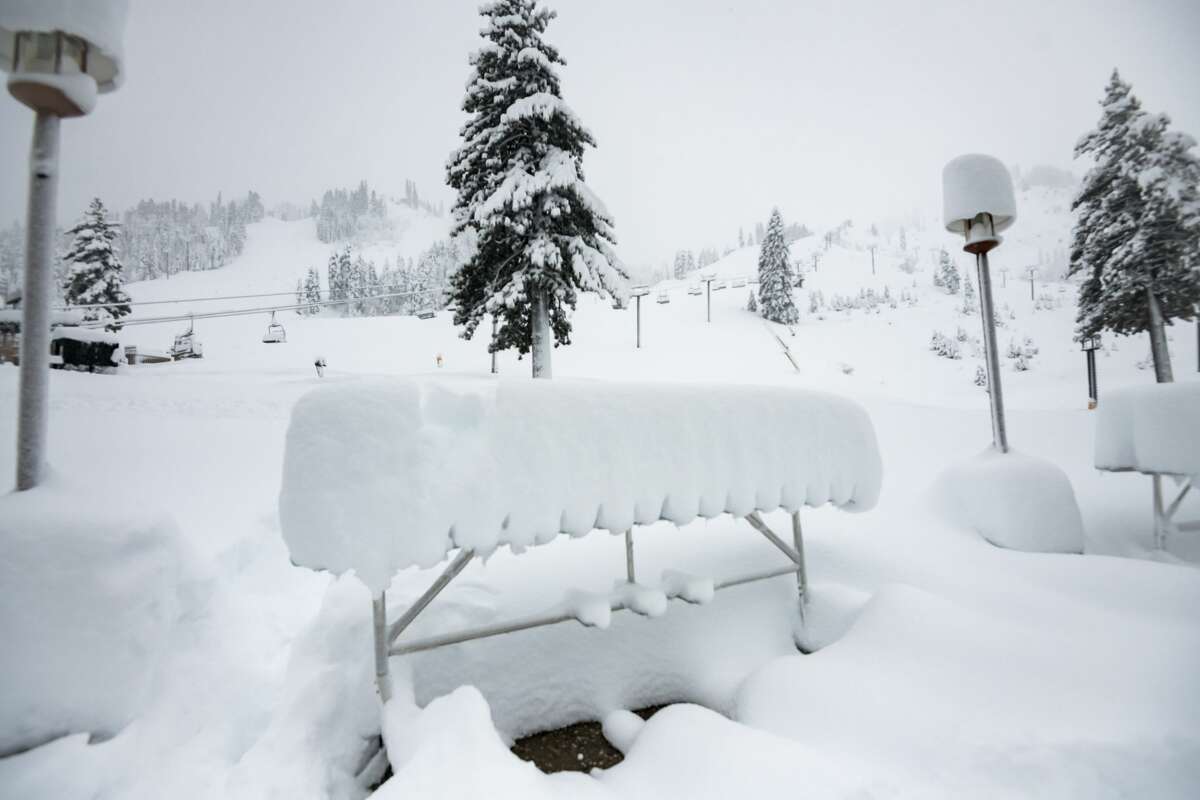
The snow fall at Palisades Tahoe on Dec. 14, 2021. The ski resort received over four feet of new snow from the atmospheric river.
Kate Abraham / Palisades Tahoe/Kate AbrahamThe drought is far from over in California, but this week's atmospheric river may have begun to put a small dent in the state's worrisome water deficit.
While a prior October atmospheric event earlier in the year brought historic rainfall totals to Northern California, this most recent storm delivered drenching rains to both the north and the south and blasted the Sierra Nevada with snow. Locations across the state reported impressive storm totals, from 11 inches of rain atop Mount Tamalpais in Marin County, to over 60 inches of snow at the UC Berkeley Central Sierra Snow Lab in Soda Springs, to 8.18 inches at San Marcos Pass in Santa Barbara County.
"This storm had a bigger spatial footprint than the October one," said Jeanine Jones, drought manager for the California Department of Water Resources. "And it was a cold storm that brought snow and it pushed into Southern California, which had been the neglected stepchild, so it was good for them even if it caused some messy street flooding."
Jones added: "It was the first cold winter storm that we’ve had and it really bolstered the snowpack ... or started the snowpack. If you looked at the snow sensors before this storm, there really wasn't much."
Marty Ralph, the director of the Center for Western Weather and Water Extremes with the Scripps Institution of Oceanography in San Diego, called the storm "productive" in terms of rain and snow.
"Up to over 10 inches of rain or liquid equivalent snow in some areas along the Central California coast and Sierras where the atmospheric river was strongest and lingered a bit longer," Ralph wrote in an email. "This provided a useful boost to the water outlook, including 10% of the annual average total for the northern Sierras. Southern California benefited from a wetter scenario than expected, including San Diego County receiving about 10% of its annual average precipitation in one day. This was one of the top 1% wettest of all wet days on record there, and brought the season total there to about normal for this time of year."
The October atmospheric river that swept Northern California was the wettest storm of the season so far and occurred at a time when severe storms are unusual. The water levels on the state's largest reservoirs rose significantly higher; Lake Oroville rose some 20 feet in a week.
"It was a very warm storm. It was a category 5 atmospheric river so it was exceptionally wet," said Jones, noting that it was given the highest severity level in the ranking scale that runs from AR1 to AR3. "If you happened to be right underneath the center point of the moisture plume, you did very well. That was the case for Lake Oroville and Folsom Lake, which came up quite a bit. If you were one of the southern San Joaquin reservoirs, it really didn't do a darn thing for you."
The more recent atmospheric river was categorized as an AR3 event and transported less moisture than the October storm, Ralph said. With the December event, the water levels on Northern California's two largest reservoirs, Shasta and Oroville, which are key water sources for the state, didn't see significant rises — but that wasn't only because the storm was less wet than the October atmospheric river.
"This was a cold storm so a lot of that precipitation fell as snow rather than rain," Jones said of the recent storm. "Keep in mind when you’re looking at really large reservoirs like Oroville or Shasta, it takes a lot of water to fill those reservoirs quickly."
The snow is important to build up the Sierra Nevada snowpack that accounts for about 30% of California's water supply in a good year. The snow that fell this week will eventually make its way into the reservoirs in the spring and summer when temperatures warm.
“The nice thing about the snowpack is that it kinds of meters the water into the system,” said Jan Null, a meteorologist who runs the private forecasting service Golden Gate Weather Services.
The Sierra Nevada snowpack went from being 19% of normal for this time of year before the storm on Dec. 10 to 83% of normal on Dec. 15.
While this is promising, the state still needs to see significantly more snow through winter to end up with an average snowpack. The snowpack is only 20% of its April 1 average, the point when it typically hits its peak.
"Much of Northern California is above or at average precipitation for December, but the question is what happens the rest of the wet season," Jones said. "It’s certainly possible that we could revert to dry conditions next month, for example. In fact, some of the research models that NOAA [National Oceanic and Atmospheric Administration] produces suggest that fact. We won’t know that until it happens. I would point out that with La Niña conditions present that suggests that Southern California will likely end up dry at the end of the season."


No comments:
Post a Comment