begin quote from:https://www.wbrc.com/2021/08/29/first-alert-ida-rapidly-intensifies-into-category-4-hurricane-strong-storms-possible-sunday-afternoon-central-al/
FIRST ALERT: Hurricane Ida makes landfall in Louisiana as a Cat 4 storm
BIRMINGHAM, Ala. (WBRC) - UPDATE: Hurricane Ida made landfall at 11:55 AM CT (8/29/21) near Port Fourchon, Louisiana with winds at 150 mph.
According to the NWS, Hurricane Ida’s northern eyewall started by moving onshore along the SE Louisiana coast. Conditions will continue to deteriorate across SE Louisiana over the next few hours.
Hurricane Ida rapidly intensified overnight from a Category 2 hurricane to a Category 4. Wind speeds are holding on to 150 mph with gusts up to 185 mph as it slams into the southeastern coast of Louisiana. Ida will impact our area over the next couple of days. It is why we have declared Monday and Tuesday a First Alert Weather Day for the potential to see heavy rainfall, flash flooding, gusty winds, and an isolated tornado threat. Biggest window for nasty weather will likely occur Monday morning through 1 PM Tuesday.
First Alert AccuTrack Satellite and Radar is showing the outer rain bands of Ida impacting Louisiana and the Mississippi and Alabama Gulf Coast. Locally we are dry with temperatures warming up into the low to mid 80s. We will likely stay dry during the early afternoon hours, but rain chances are forecast to increase by this evening. Some of the outer rain bands of Ida could move into our southern counties and move off to the north-northwest. Plan for a mostly cloudy sky today with a 50% chance for scattered showers and thunderstorms. Highs today will likely climb into the upper 80s to near 90°F. I want to give everyone a First Alert that we do have the potential to see a few strong or severe storms today well in advance of Ida. Main threats will be gusty winds up to 40-50 mph, frequent lightning, and very heavy rainfall. The tornado threat is very low, but not zero. Greatest risk for isolated tornadoes today will likely remain in southwest Alabama. Just have ways to receive weather updates today. You will definitely need multiple ways to receive warnings tomorrow and Tuesday as Ida impacts our area. Tonight we could see a break from the rain, but the outer rain bands of Ida will likely begin to move into our western counties around sunrise Monday morning. Plan for temperatures to cool into the low to mid 70s with a cloudy sky. Rain chance tonight around 20-30%.
/cloudfront-us-east-1.images.arcpublishing.com/gray/BOWRQ3GOLJHQJB35GYW763524Q.png)
Hurricane Ida: Hurricane Ida is forecast to make landfall in southeast Louisiana near Grand Isle, Golden Meadow, and Houma as a Category 4 hurricane with winds up to 150 mph. New Orleans will remain on the right side of the storm. It will bring widespread damage to parts of southeast Louisiana including New Orleans. Storm surge up to 10-15 feet is possible along the central and southeast coastline of Louisiana this afternoon. Storm surge up to 2-4 feet is possible as far east as the Alabama coast where tropical storm warnings have been issued. Ida will weaken and slow down a little once over land. It is forecast to become a tropical storm once in southwest Mississippi Monday morning. It will then weaken into a tropical depression as it moves into northeast Mississippi Tuesday evening.
/cloudfront-us-east-1.images.arcpublishing.com/gray/KTJZRAK6RZEDHNM2ZGPFXSAQZA.png)
FIRST ALERT WEATHER DAY MONDAY AND TUESDAY: We will remain on the right front quadrant of Ida which means we will see rounds of rain, wind, and the potential for isolated tornadoes. The threat ramps up Monday morning and could peak Monday night into Tuesday morning. Monday afternoon could present us with outer squalls that could produce very heavy rainfall, potential flash flooding, and the threat for isolated tornadoes. Tornadoes that form in tropical systems usually only last for a short period of time and cycle quickly. Take all warnings seriously Monday and Tuesday. Wind speeds Monday will be around 10-15 mph with gusts near 25 mph. Some of the outer rain bands could produce wind gusts up to 40 mph. Threat will begin in west Alabama and spread northwards over time. Temperatures could briefly warm up into the mid 80s Monday afternoon, but temperatures will cool down a little once rain moves in. It will feel very muggy and tropical.
Monday Night: I think the main batch of rain and wind will likely occur Monday night into Tuesday morning. Sustained winds of 15-25 mph will be possible with wind gusts up to 40 mph is possible as the bands of rain move through Central Alabama. We could see isolated wind gusts up to 50 mph in far west Alabama since they will be closer to the center of circulation of Ida. Monday night will be very wet. I would avoid driving on the roads. We will hold on to an isolated tornado threat during the overnight hours. Make sure you have multiple ways to receive warnings overnight. A NOAA Weather Radio is highly recommended as it can wake you up while sleeping. Temperatures will cool into the low to mid 70s.
Tuesday: The First Alert Weather Day continues through the first half of Tuesday as Ida continues to weaken and stays to our north in parts of Tennessee. We will have to see how much instability will be present in the afternoon hours to help produce some strong and severe storms. The threat for isolated tornadoes won’t end until Tuesday evening. Rain will be likely in the morning and early afternoon hours. We should see rain chances diminish in coverage and intensity by Tuesday evening. Highs Tuesday afternoon will likely stay in the upper 70s and lower 80s for most locations.
Rainfall Potential in Central Alabama: West Alabama will clearly see the highest rainfall totals from Ida. Rainfall projections indicate totals of 2-5″ is likely with some spots receiving over 5 inches of rainfall. Areas along I-65 and points to the east could still record a few inches of rain. A flash flood watch has been issued for areas along and west of I-65 starting Monday and ending Tuesday evening. It includes the cities of Cullman, Birmingham, Alabaster, Tuscaloosa, Jasper, and Hamilton. If heavy rain bands set up, we could see even higher totals than that. We’ve seen so much rain this summer that flash flooding can’t be ruled out. Remember to never drive through flooded areas. Turn around, don’t drown.
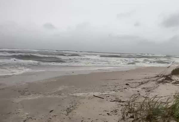
Alabama Gulf Coast: Conditions will go downhill all day today. Winds could be near tropical storm force as the outer rain bands impact southwest Alabama. Tornadoes will be a major concern today and tomorrow as Ida approaches the coast. Storm surge of 2-4 feet is possible along the Alabama Gulf Coast. No one should be on the beach. Conditions will improve by Tuesday as Ida moves away.
Weather Improves Wednesday: Most of the energy from Ida will move away from us on Wednesday giving us a small chance for lingering showers and storms. We will likely start Wednesday off cloudy with temperatures in the upper 60s. Cloud cover should slowly decrease throughout the day with highs in the mid 80s.
Nice Weather Heading into Labor Day Weekend: The good news after Ida is that our weather will improve significantly Thursday and into the weekend! We will likely see lower humidity levels and plenty of sunshine. Temperatures Thursday morning could drop into the lower 60s. Some of our models are hinting at lows in the upper 50s for parts of north Alabama. It should feel very refreshing. Highs Thursday are forecast to remain below average with highs in the mid 80s. Weekend will remain nice, but temperatures will slowly warm back into the upper 80s and lower 90s with lows in the mid to upper 60s.
Tropical Update: The Atlantic remains very active. The good news is that despite several systems in the Atlantic, most of them will not impact the United States. We have Tropical Depression Ten and Tropical Depression Eleven in the Atlantic that could become our next named storms. We are also watching a tropical wave off the coast of Africa that has a high chance to develop. Finally, a weak area of low pressure of the Northeast United States has a low chance to develop over the next couple of days. We are entering the peak of the hurricane season. Hurricane season ends on November 30th.
Have a safe day and keep monitoring the weather as Ida impacts the Southeast today through Tuesday. Make sure you download the WBRC First Alert Weather App for the latest updates.
Copyright 2021 WBRC. All rights reserved.

No comments:
Post a Comment