begin quote from:
Live updates: Zogg Fire grows to 7,000 acres; officials brace for fire to enter Trinity County
Update, 11:35 p.m., Sunday, Sept. 28
The Shasta County Sheriff's Office is asking residents, whose property is in the Zogg Fire evacuation zone and have been told to leave, to heed the order.
The road closures and evacuations are in place for your safety, the sheriff's office said in a Facebook post late Sunday night.
"It is not safe, for you or the first responders working on the fire, for you to enter closed areas to view the fire. Even if you think you are far enough away, emergency personnel are constantly coming and going on those roads responding to this emergency," the post reads in part.
More:Here's how you can sign up for Code Red alerts in Shasta County
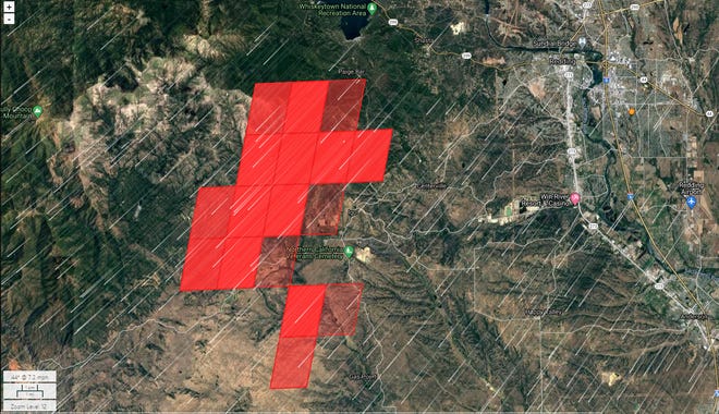
Click to here to seethe Interactive map above.
More:Road closures ordered as Zogg Fire in Igo near Redding continues to grow
More:See list of mandatory evacuation areas as Zogg Fire near Redding continues to grow
Update, 8 p.m., Sunday, Sept. 27
Due to the Zogg Fire, Igo-Ono School will be closed Monday, Shasta County Superintendent of Schools Judy Flores announced.
Firefighters are using the school as a staging area.
In addition, the Happy Valley School District will be closed Monday, District Administrative Assistant Taylor Barton said.
Update, 7:15 p.m., Sunday, Sept. 27
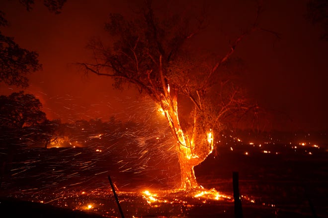
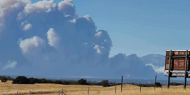
The Zogg Fire has grown to 7,000 acres, Cal Fire said.
The cause of the fire, which started just before 3 p.m. Sunday, is under investigation.
The fire continues to be fanned by north winds as the National Weather Service has a red flag warning in place until 9 p.m. Monday.
Update, 6:45 p.m., Sunday, Sept. 27
Already raging in Shasta County, authorities are bracing for the Zogg Fire to blow into Trinity County.
At 6 p.m., the California Highway Patrol closed Highway 36 at Wildwood Road in Trinity County.
Update, 5:45 p.m., Sunday, Sept. 27
Authorities have ordered mandatory evacuations from Platina Road west to the Tehama County line.
Residents are advised to evacuate east on Highway 36 to the collection point at Holiday Market on Gas Point Road in Cottonwood, Cal Fire said.
The fire appears to be burning southwest away from Redding as it's being driven by strong winds coming from the north.
Update, 5:25 p.m., Sunday, Sept. 27
The Zogg Fire has grown to 1,000 acres, Cal Fire said.
The fire was first reported just before 3 p.m. and quickly grew to 400 acres.
The fire is being fanned by strong, north winds that are gusting to 30-40 mph with low humidity, the National Weather Service said. A Red Flag Warning for the area has been extended to 9 p.m. Monday.
Update, 5:15 p.m., Sunday, Sept. 27
Authorities are now sending Code Red emergency notifications to all roads off Platina Road west to the Shasta County line and east to Tehama County line.
Update, 4:45 p.m., Sunday, Sept. 27
Cal Fire says residents evacuating from the Zogg Fire can go to the Holiday Market at 20635 Gas Point Road in Cottonwood.
The agency is calling that a "collection point."
Original story
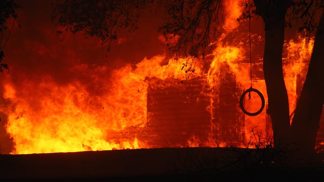
Evacuations were taking place Sunday afternoon after a fast-moving, 400-acre vegetation fire burned off Zogg Mine Road in Igo.
The blaze was reported at 2:51 p.m. in the area of Zogg Mine Road and South Fork Road, according to scanner reports.
The Shasta County Sheriff's Office was handling immediate evacuations for areas west of Zogg Mine Road. Code Red alerts were issued for mandatory evacuations in the area.
Mandatory evacuations are in effect for all areas south of South Fork Road and Zogg Mine Rd, and south along the Gas Point Road corridor, including all residents along Gas Point Road to Foster Drive, according to the sheriff's office.
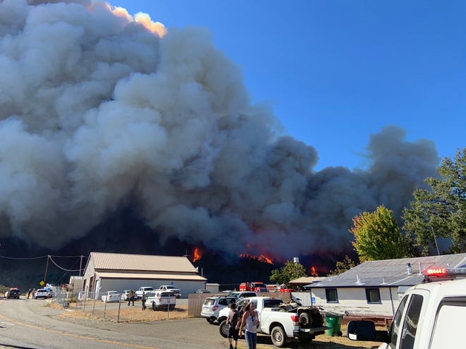
Firefighters are staging at Igo elementary school at 6429 Placer Road.
Deputies received several requests from residents unable to evacuate as the fire got closer to their homes.
California fire tracker:Map traces Igo Fire, other fires burning across state in real-time
Ten people who were reportedly trapped in the 8600 block of Zogg Mine Road were safely evacuated, according to scanner reports.
Spot fires started along Cloverdale and Clear Creek roads several miles from the fire's original location.
Road closures were in effect on Clear Creek Road at Cloverdale Road, Platina Road at Rainbow Lake Road, and Placer Road at the Clear Creek Bridge, known as the Shasta County Vietnam Veterans Memorial Bridge, and at Placer Road and Muletown Road.
Air tankers made retardant drops to protect residences. Seven bulldozers were requested to dig fire lines.
Meanwhile, another fire was reported just after 4 p.m. in the area of Twin View Blvd. and Highway 273.
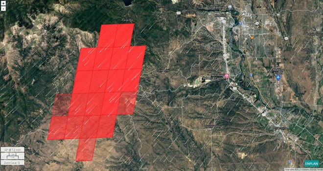
Click to here to seethe Interactive map above.
Check back for updates.
Mike Chapman is a reporter and photographer for the Record Searchlight in Redding, Calif. His newspaper career spans Yreka and Eureka in Northern California and Bellingham, Wash. Follow him on Twitter @mikechapman_RS. Subscribe today!
No comments:
Post a Comment