Terrifying images show fiery column looming over Caldor Fire near Lake Tahoe

The Caldor Fire 40 miles southwest of Lake Tahoe, Calif., rages on Aug. 17, 2021.
AlertWildfire/Handout-Updates: Get info on the Caldor Fire from the El Dorado National Forest.
-Information line: (530) 303-2455
-Maps: Find from the U.S. Forest Service.
Wildfire cameras captured terrifying images Monday afternoon of the massive column of smoke and flames rising up from the Caldor Fire burning near Lake Tahoe.
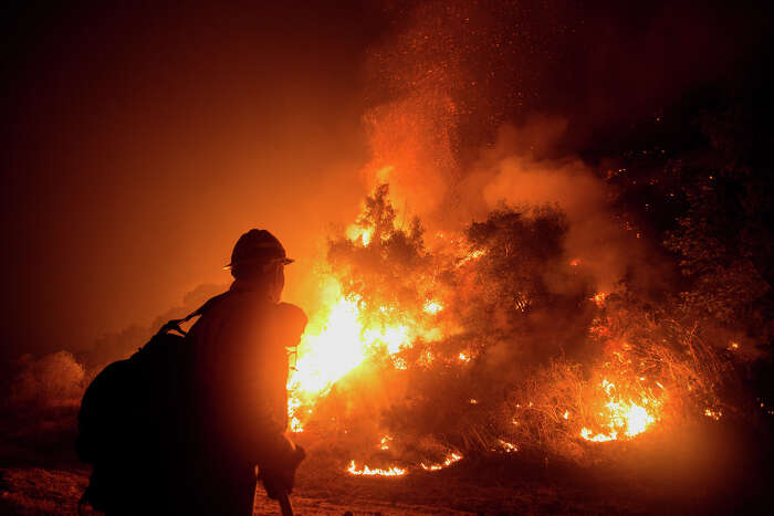
The wildfire camera positioned on Leek Spring Hill, about 40 miles southwest of South Lake Tahoe, showed the blaze looking more like an erupting volcano than the type of wildfires that Californians are sadly accustomed to.
"Radar shows the smoke plume at about 20,000 feet," said Cory Mueller, a meteorologist with the National Weather Service's Sacramento office. "For a fire, that’s pretty good."
"It's very scary," said Neil Lareau, a professor of atmospheric sciences in the department of physics at the University of Nevada at Reno who studies wildfire-generated weather. "We have the worst mix of things you could put together for fires, which is a combination of dry vegetation, strong, shifting winds and an atmosphere conducive to these deep smoke plumes."
Lareau estimated the column's height at about 24,000 feet.
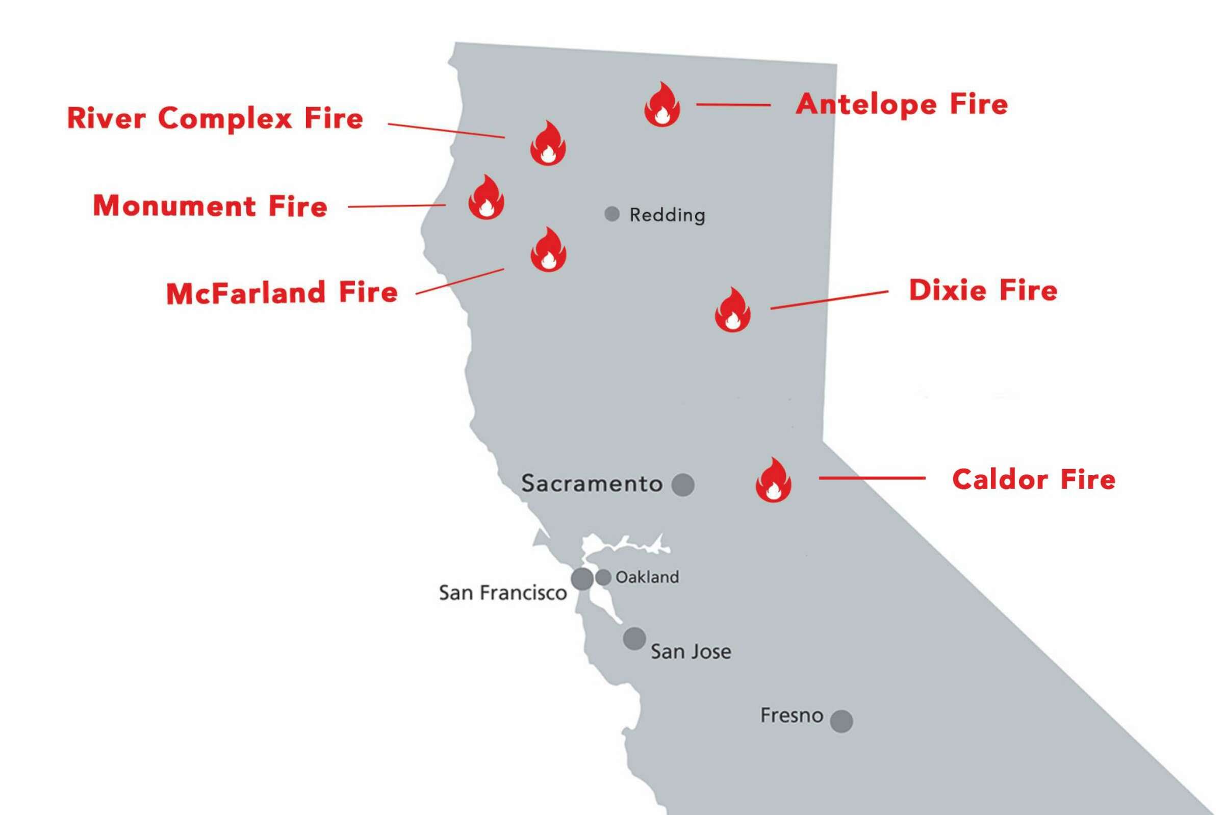
The Caldor Fire ignited Saturday evening in the El Dorado National Forest and grew from 2,261 acres Monday night to 6,500 acres Tuesday morning, burning through heavy timber in a steep river canyon, Cal Fire said. It is zero percent contained.
Read more about the Caldor Fire on SFGATE.

Guy Tucker photographed the Caldor Fire 3 miles due west from Fair Play, Calif., late Monday night on Aug. 16, 2021.
Courtesy Guy Tucker / @wine.alchemyMueller said the highly active blaze is pumping out what's known as a pyrocumulus cloud. These massive clouds form over volcanic eruptions or forest fires when an intense heating of the air triggers an upward motion, pushing smoke and water vapor to rapidly rise. Sometimes these clouds generate their own weather systems.
"For really strong severe thunderstorms to develop, the plume usually has to be in the 40,000 range," Mueller said. "So we’re not seeing that, which is good."
Lareau observed rotating columns of smoke within the cloud through radar imagery. "They're nothing like a tornado strength but they're very significant plume dynamics that contribute to the fire intensity," he said.

Smoke billows into Sierra-at-Tahoe as the Caldor Fire burns Aug. 17, 2021.
AlertWildfire/HandoutThe Caldor Fire has seen extreme fire activity due to gusty winds, hot temperatures, low humidity and dry vegetation.
Wildfires are burning across Northern California amid hot, bone-dry weather.
Photo Illustration: SFGATE/ Getty Images"Forecast winds over the next 3 days have been associated with aggressive fire growth and runs of 3+ miles are probable in the absence of an inversion," the U.S. Forest Service cautioned in its latest weather report. (For an explanation of inversions, see the U.S. Forest Service.)
Winds were blowing in a westerly direction Monday afternoon at about 10 mph to 15 mph and are forecast to switch to easterly and northeasterly.
"Hopefully it [the offshore winds] will push the fire back into what has already burned," Mueller said.

end quote from: https://www.sfgate.com/california-wildfires/article/caldor-fire-tahoe-smoke-california-fires-16393428.phpFor more wildfire coverage, visit our California wildfires page.
No comments:
Post a Comment