begin quote from:
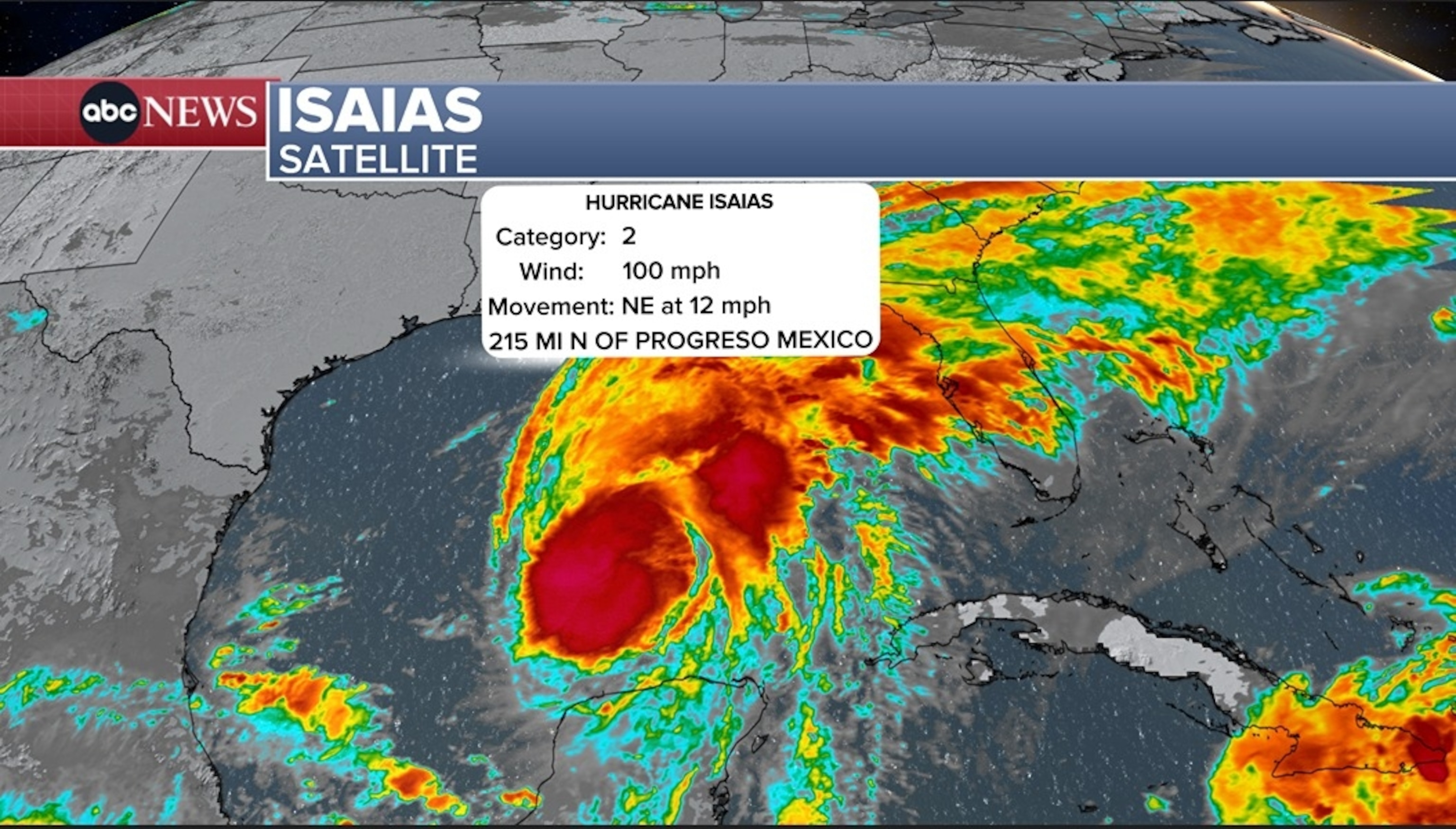
The Gulf Coast is on high alert as Isaias strengthened into a Category 2 hurricane on Thursday as it continued moving north toward the Florida Panhandle.
The National Hurricane Center said the storm, which first strengthened into a hurricane late Wednesday night, had intensified into a Category 2 storm on with winds up to 105 mph as of Thursday night.
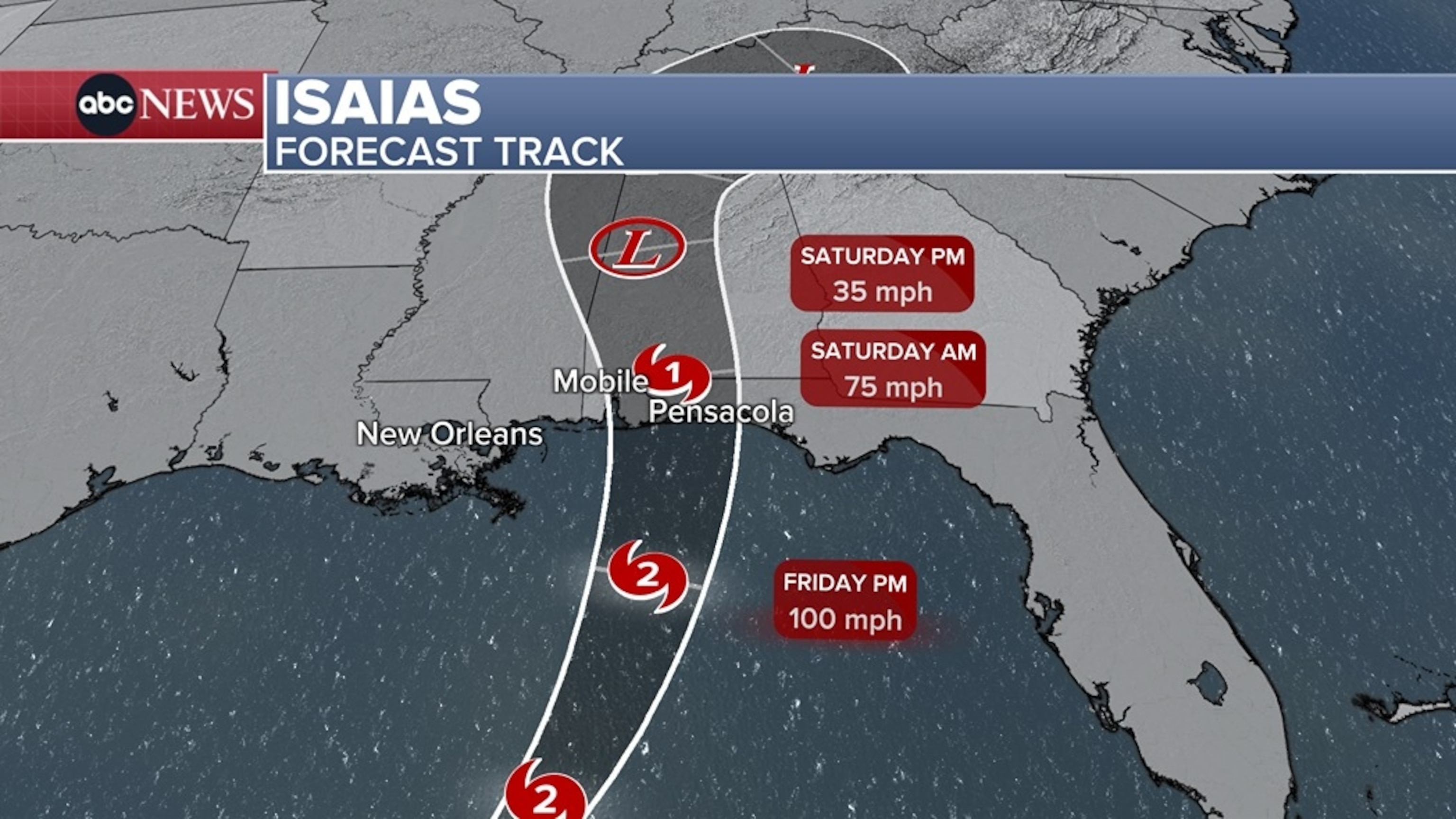
The storm is forecast to make landfall Friday night.

It's the first Atlantic hurricane of the season, making it the latest first hurricane on record.
As of Thursday night, winds were up to 105 mph with higher gusts, and the storm was about 260 miles from the Mississippi coast.
Isaias could briefly become a major hurricane early Friday. Although some weakening is forecast thereafter, Isaias will remain a dangerous hurricane as it approaches the northern Gulf Coast late Friday.
Hurricane and storm surge warnings are in effect for parts of the northern Gulf Coast.
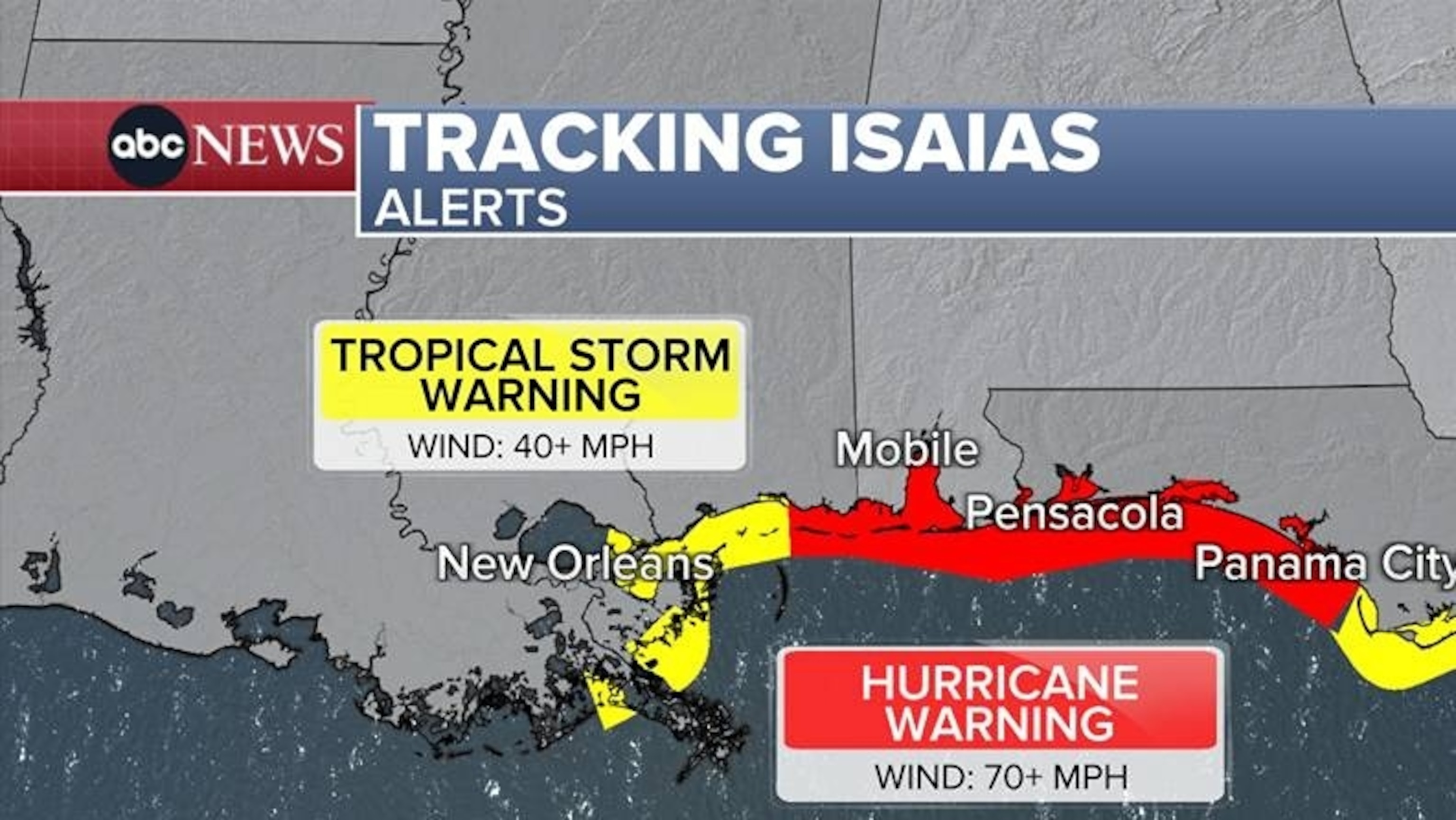
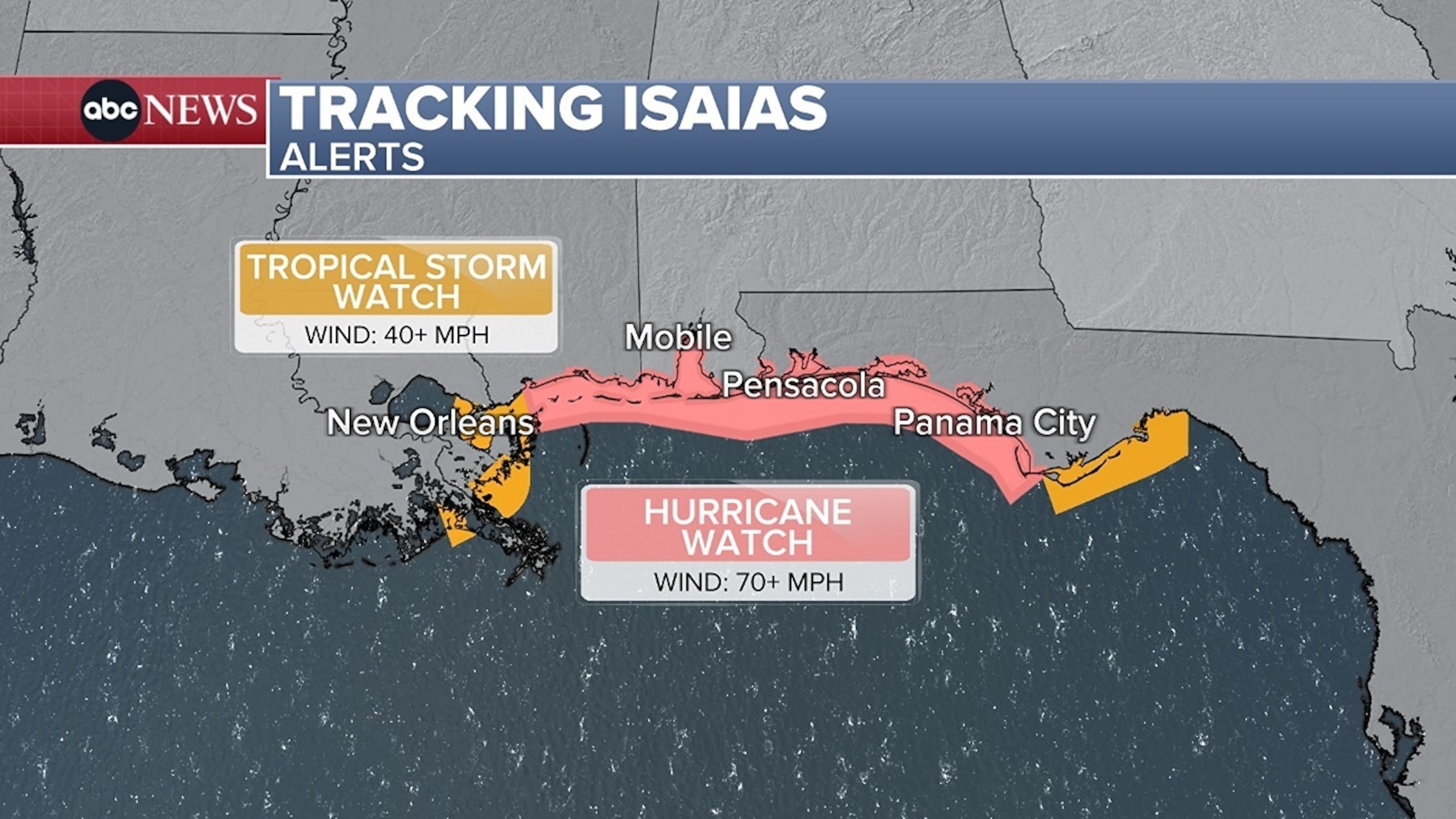
A previously issued hurricane watch was upgraded to a hurricane warning from Ocean Springs, Mississippi, to the Bay-Gulf County Line in Florida.
Florida issued a state of emergency order Tuesday evening for 25 counties and on Wednesday, Alabama issued one for 40 counties.
Evacuation orders have been issued for several Florida counties in coastal and low-lying areas. Evacuation centers have been set up, officials said.
"If you are in those evacuation zones, heed the call," Florida Gov. Ron DeSantis said in a press conference Thursday afternoon. "There's options, there's shelters, you have family, friends, however you want to do it. Let the storm pass and then go on and get everything situated again."
DeSantis said he mobilized the Florida National Guard and other emergency teams such as the Florida Division of Emergency Management and Florida Highway Patrol to stockpile supplies, restore power in the event of outages and facilitate evacuations.
Alabama Gov. Kay Ivey issued several warnings to residents Thursday to prepare for the storm. In a video statement, she said there was a mandatory evacuation for non-residents, tourists and visitors in Baldwin County south of the Gulf Intracoastal Waterway, including Gulf Shores and Orange Beach, and on Dauphin Island in Mobile County.
The latest forecast shows the storm shifting a bit more east, with a landfall closer to Pensacola late Friday night.
The storm is expected to weaken before making landfall, likely as a Category 1 hurricane.
Rain from Isaias may reach the New Orleans to Pensacola region along the Gulf Coast on Friday morning, bringing potentially tropical storm-force winds.
From Friday through the weekend, Isaias is expected to produce 4 to 8 inches of rain across the central U.S. Gulf Coast, with localized totals of up to 15 inches.
There is also an isolated risk for tornadoes in those areas.
Large, dangerous waves are expected to accompany the surges along the coast near and east of the storm's landfall location.
The highest storm surges could reach 5 to 7 feet from the Mississippi coast to the western panhandle of Florida.
Storm surge warnings are in effect from the mouth of the Mississippi River to Horseshoe Beach in Florida.
Isaias will be weakening and become a rainmaker on Saturday across the South - especially for inland portions of Mississippi and Alabama.
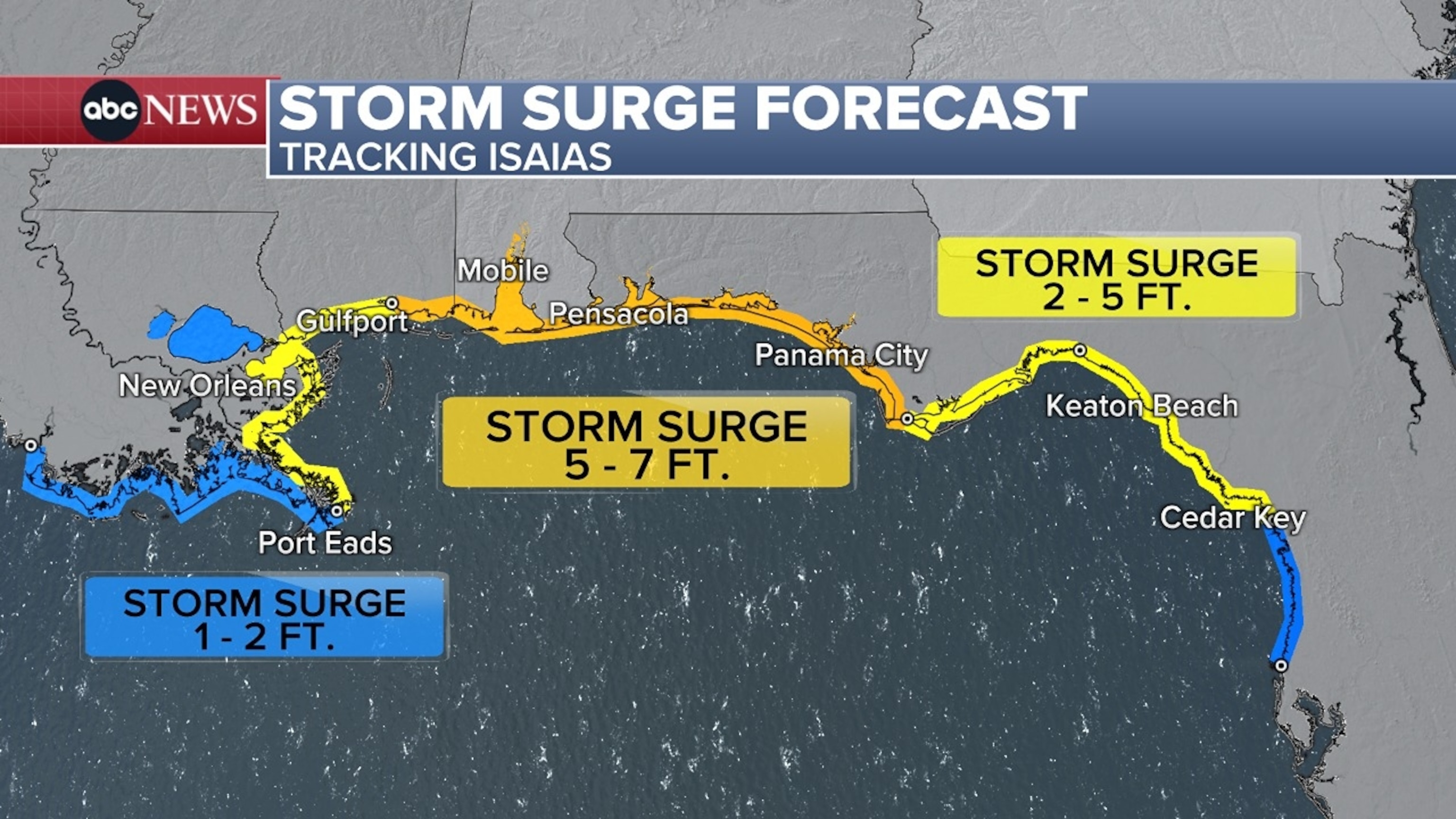
Flooding from the surge can vary greatly over short distances depending on the timing of the surge and tidal cycle.


No comments:
Post a Comment