Colorado wildfire update: Monsoon moisture calms flames, raises threats of flash floods
Residents heading back to their homes as more evacuation orders are being lifted
Wildfires continue to burn in Colorado, and recent rains have helped firefighters in expanding containment lines and battling the blazes, which have scorched more than 182,000 acres statewide this season.
Recent gains by firefighters have resulted in more evacuation orders being lifted, with some Colorado residents heading back to their homes.
Spring Creek fire
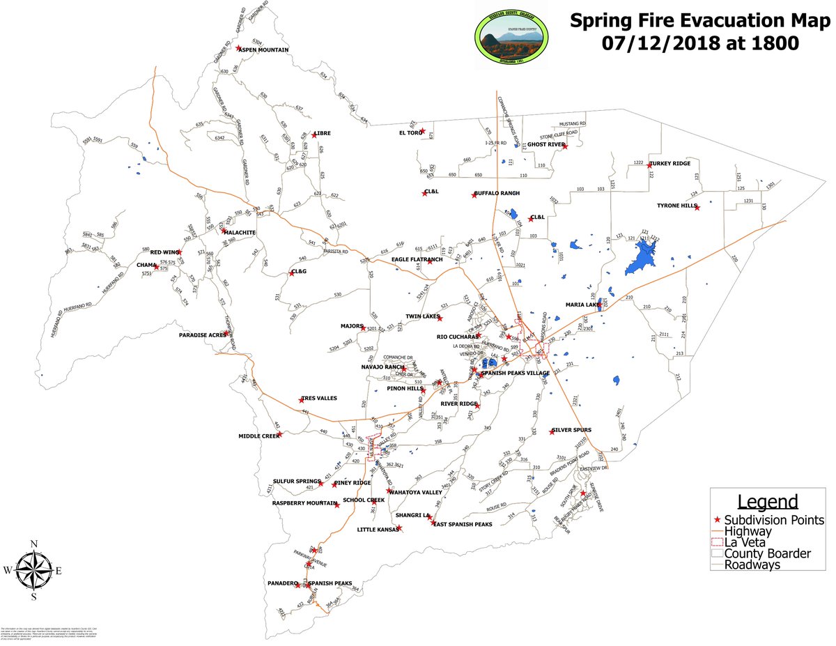
With 91 percent containment, fire evacuation orders were lifted at 6 p.m. Thursday, fire officials announced. All pre-evacuation orders were also lifted on the 108,045-acre fire, currently the third-largest in state history.
On Thursday, Jesper Joergensen, the man accused of starting the fire, was charged with 141 counts of first-degree arson — one count for each home destroyed by the blaze.
The fire continues to burn in Costilla and Huerfano counties. It started June 27 about five miles northeast of Fort Garland.
On Thursday, a flash-flood watch was posted for parts of the fire area through 9 p.m., according to the National Weather Service.
The wet weather Thursday, while calming flames, also increased the risk of flash flooding, especially in burn scar areas, the weather service said.
There’s a 50 percent chance of rain overnight Thursday in La Veta, with possible heavy storms. A 40 percent chance of showers and thunderstorms, mainly after 11 a.m., is forecast for Friday. Additional storm hazards include lightning and wind gusts up to 40 mph.
416 fire
The fire, more than 54,00 acres, is 50 percent contained, and the National Incident Management Organization relinquished command of the fire Tuesday.
“If you see smoke on the 416 fire on a hot day, that’s perfectly normal! Its a big fire, and it’ll take a lot of rain or snow to put it out completely,” said Kris Eriksen, a spokeswoman with NIMO, in a goodbye post to the community.
Eriksen warned locals to be careful in burn areas because recent wet weather raises the chance of flash flooding.
The long-burning fire started June 1 about 13 miles north of Durango. The cause of the fire is officially listed as “unknown.” Much attention has been focused on the Durango & Silverton Narrow Gauge Railroad and whether its coal burning train ignited the fire.
Weston Pass fire
All mandatory evacuations have been lifted, and the Campground of the Rockies will be on a pre-evacuation status, fire officials said Thursday.
Closures remain in effect in the Pike National Forest, including south of Park County Road 22, north of Trout Creek Pass and west of U.S. 285. The speed limit on the interstate is posted at 50 mph, and there’s a no-stopping order for motorists in the fire area.
The fire, which was started by lightning June 28 about nine miles southwest of Fairplay, has burned more than 13,000 acres. On Thursday containment was 74 percent.
Fire behavior has been limited recently, although smoke from the interior is expected to continue. Fire personnel and equipment are gradually being released. On Thursday, fewer than 500 people were working the fire.
Wildfires in Colorado and the U.S.
The map shows active wildfire locations and all 2018 fire perimeters*. The map defaults to Colorado; to see all wildfires, click “U.S.” in the view area. Click the map layers icon in the top right corner of the map to change map backgrounds and to toggle active and contained fires, and perimeters. Click a marker or perimeter for details. To view the full map and a table of all 2018 wildfires, click here.


No comments:
Post a Comment