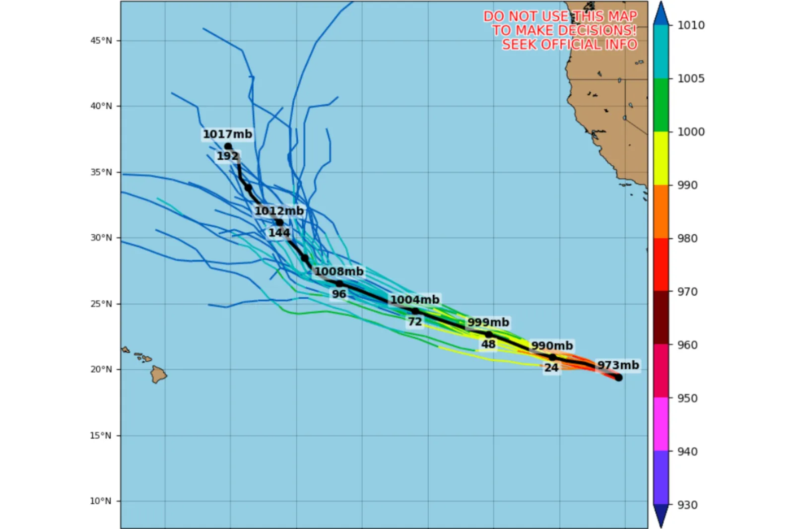
Hurricane Genevieve Spaghetti Models Show Today’s Path After Cat 5 Peak
Published
Jul 30, 2026 at 06:39 AM EDT

Hurricane Genevieve, which previously strengthened into the eastern Pacific's first Category 5 storm since 2024, is expected to weaken over the coming days as it tracks west-northwest, according to forecasters.
According to AccuWeather, Genevieve developed from a tropical depression on July 24 far off Mexico's coast, strengthening into a tropical storm later that day. It reached hurricane status on July 25 and then underwent rapid intensification on July 26, becoming a Category 4 hurricane with sustained winds of 155 miles per hour. By Sunday night, AccuWeather reported that Genevieve's winds had increased to 160 mph, making it a Category 5 hurricane.
"While eastern Pacific Major Hurricane Genevieve poses no direct threat to land, it has become the most powerful hurricane in the waters surrounding North and Central America this year and the first Category 5 hurricane since Kristy in 2024," said Alex DaSilva, lead hurricane expert at AccuWeather.

The outlet added that as of Thursday morning, Genevieve was a 100-mph, Category 2 hurricane.


No comments:
Post a Comment