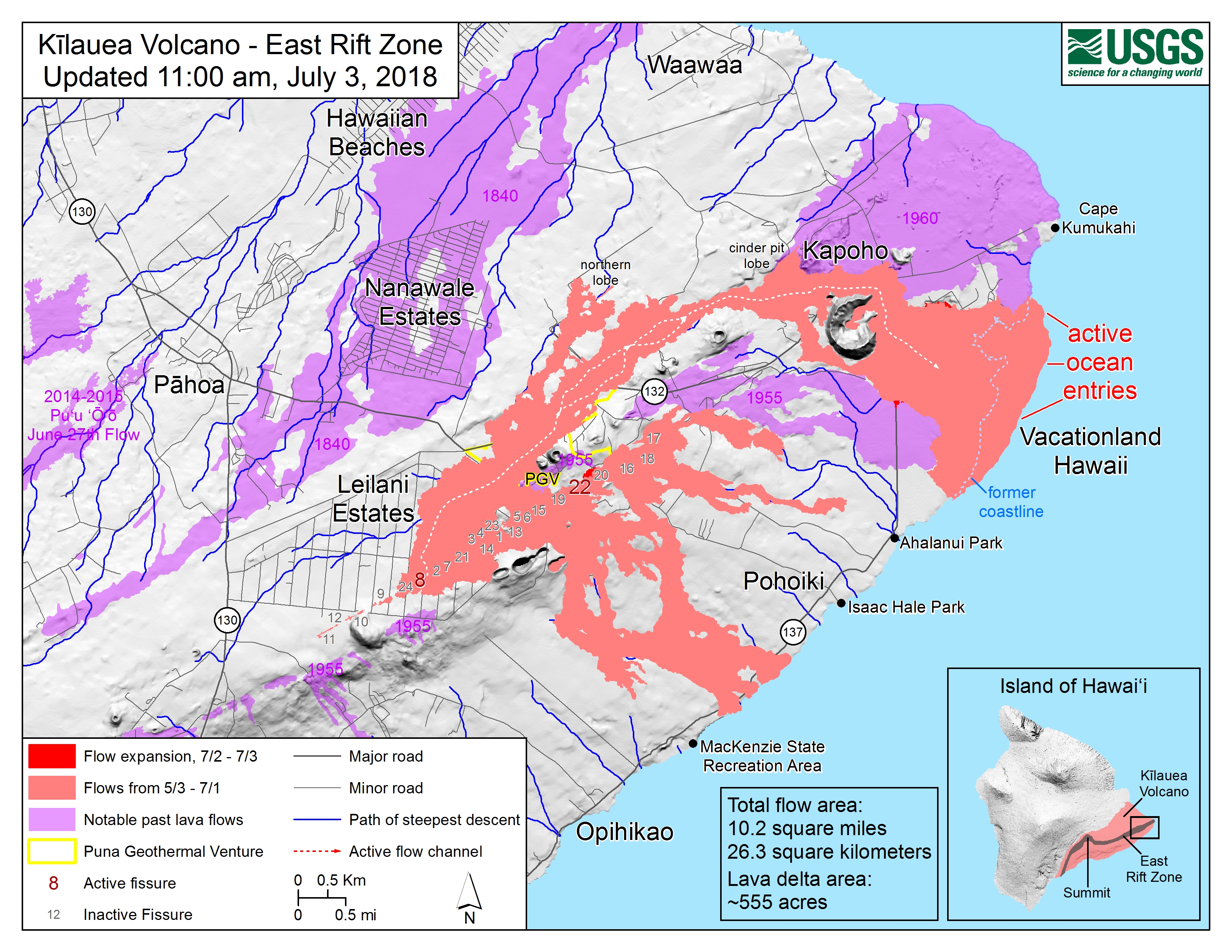
Map as of 11:00 a.m. HST, July 3, 2018. Given the dynamic nature of Kīlauea's lower East Rift Zone eruption, with changing vent locations, fissures starting and stopping, and varying rates of lava effusion, map details shown here are accurate as of the date/time noted. Shaded purple areas indicate lava flows erupted in 1840, 1955, 1960, and 2014-2015. (see large map)
end quote from:
https://volcanoes.usgs.gov/volcanoes/kilauea/multimedia_maps.html

