begin quote from:
https://www.cnn.com/2022/12/12/weather/winter-storm-system-snow-in-us-west-monday/index.html
Nationwide winter storm set to bring everything from blizzard conditions to tornadoes

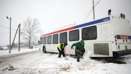
A large winter storm slammed into the western US over the weekend, blanketing mountain areas with heavy snow, and is now set to traverse the nation, threatening dangerous blizzard conditions, strong tornadoes, and flooding this week.
“This winter storm is a true coast-to-coast, top-to-bottom impact that will be felt by every person in the country at some point this week,” CNN Meteorologist Brandon Miller said.
The storm already brought avalanche warnings to parts of the West, shutting down major highways as conditions became icy.
More than 10 million people in over a dozen states are under some level of winter weather alert as the powerful storm moves across the county, bringing with it a multiday severe storm threat.
Sign up to receive weekly email updates from CNN Meteorologists.
Blinding blizzard conditions
The storm will strengthen as it travels eastward, bringing snow to the Rockies tonight, where a foot of snow is expected before the system strengthens even more.
The Upper Midwest, and northern and central Plains will get hit the hardest Monday night into Tuesday as widespread heavy snow falls.
“Snow accumulations through Tuesday morning will generally range between 6 to 12 inches, centered on the Northern High Plains,” the weather prediction center said. “The highest snow totals are currently forecast for western South Dakota and northwestern Nebraska, where upwards of 18 to 24 inches is possible.”
Meanwhile, a widespread area from eastern Wyoming and Colorado to western South Dakota and Nebraska will also have winds gusts as high as 60 mph. Heavy snowfall and strong winds will set the stage for a blizzard, leading to whiteout conditions and impossible travel.
Blizzard conditions are when there are sustained winds of 35 mph or higher and visibility below a quarter mile for at least three consecutive hours.
Winter storm alerts stretch from the Canadian border to the Mexican border and blizzard warnings extend from just west of Denver into the Dakotas.
“All preparations for this storm should be well underway and completed sooner rather than later,” the National Weather Service office in Rapid City said.
Some locales inside the blizzard warning areas could pick up as much as 20 inches of snow. The winds could be strong enough to knock down tree limbs and cause power outages, and the harsh conditions could be deadly for anyone outdoors.
“The cold wind chills, as low as 20 below zero, could cause frostbite on exposed skin in as little as 30 minutes,” the weather service office in Cheyenne, Wyoming, said.
Further east, ice warnings blanket eastern North Dakota, where nearly half an inch of ice could accumulate. If it materializes, power outages are certain and travel will be impossible.
Icing is also possible across southwestern Minnesota and western Iowa, where as much as a tenth of an inch of ice could develop.
Multiday severe storm threat
While the storm brings whiteout conditions to the North, the southern section of the storm will have the potential to bring late-season tornadoes along with strong thunderstorms.
On Monday evening, storms will fire up across western Kansas, as well as across portions of Texas and Oklahoma. The Storm Prediction Center is expecting storms to rapidly develop tonight, after dark.
A Level 2 of 5 risk of severe weather has been issued for the area, including Oklahoma City and Norman in Oklahoma as well as Colby and Garden City in Kansas, and Wichita Falls in Texas.
“Occasional damaging winds, isolated large hail, and a couple of tornadoes will be possible tonight,” the Storm Prediction Center said.
Track the storms as they develop here.
As the storm system strengthens and pushes eastward on Tuesday, the possibility of damaging winds, hail, flash flooding and even strong tornadoes will be a concern for portions of the Deep South, especially central Louisiana and eastern Texas.
“All modes of severe will be possible with damaging winds, hail and some more late fall tornadoes,” the weather service office in Shreveport said.
Shreveport, Monroe and Alexandria in Louisiana are in a Level 3 of 5 risk for severe weather. Dallas, Fort Worth, and New Orleans are under a Level 2 risk.


No comments:
Post a Comment