begin quote from:
https://weather.com/weather/alerts/localalerts/l/Santa+Barbara+CA?canonicalCityId=544856cc5db6fc320238353421424031798795427cf76295e642a235c0511315
Weather Alerts-Santa Barbara, CA
Gale Warning
Until Mon 3 am PDT
1 of 3
Action Recommended
Avoid the subject event as per the instructions
Issued By
Los Angeles - CA, US, National Weather Service
Affected Area
Portions of the coastal waters of southwest California
Description
...GALE WARNING REMAINS IN EFFECT UNTIL 3 AM PDT MONDAY...
WHAT...Northwest winds 20 to 30 kt with gusts up to 45 kt and combined seas 9 to 14 ft when conditions are worst.
WHERE...Portions of the coastal waters of southwest California.
WHEN...Until 3 AM PDT Monday.
IMPACTS...Strong winds will create dangerous sea conditions which could capsize or damage small and large vessels.
ADDITIONAL DETAILS...See the Coastal Waters Forecast (CWFLOX) for more.
PRECAUTIONARY/PREPAREDNESS ACTIONS...
Mariners should alter plans to avoid these hazardous conditions. Remain in port, seek safe harbor, alter course, and/or secure the vessel for severe conditions.
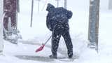
Wind Advisory
From Sun 4 pm until Mon 3 am PDT
2 of 3
Action Recommended
Execute a pre-planned activity identified in the instructions
Issued By
Los Angeles - CA, US, National Weather Service
Affected Area
Santa Barbara County Southwestern Coast and Santa Barbara County Southeastern Coast
Description
...WIND ADVISORY REMAINS IN EFFECT FROM 4 PM THIS AFTERNOON TO 3 AM PDT MONDAY...
WHAT...Northwest winds 25 to 35 mph with gusts up to 50 mph expected.
WHERE...Santa Barbara County Southwestern Coast and Santa Barbara County Southeastern Coast.
WHEN...From 4 PM this afternoon to 3 AM PDT Monday.
IMPACTS...Gusty winds will blow around unsecured objects and make driving difficult, especially for high profile vehicles. Tree limbs could be blown down and a few power outages may result.
PRECAUTIONARY/PREPAREDNESS ACTIONS...
Use extra caution when driving, especially if operating a high profile vehicle. Secure outdoor objects.
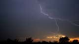
Marine Weather Statement
Until Sun 6 pm PDT
3 of 3
Action Recommended
Attend to information sources as described in the instructions
Issued By
Los Angeles - CA, US, National Weather Service
Affected Area
East Santa Barbara Channel from Pt. Conception to Pt. Mugu CA including Santa Cruz Island
Description
...ISOLATED THUNDERSTORMS THROUGH THIS AFTERNOON... ...HAZARDOUS SEAS AND GALE FORCE WINDS THROUGH TONIGHT...
A moist and unstable airmass with a pocket of cold air aloft will support a slight chance of thunderstorms through this afternoon across portions of the southwest California coastal waters.
Any thunderstorms that form will be capable of producing dangerous lightning, brief heavy rainfall and small hail. If threatening weather is observed, mariners are advised to seek safe harbor.
In addition to the thunderstorm threat, gale force winds with hazardous to potentially dangerous steep, choppy seas will affect much of the coastal waters through tonight. Small craft should stay in port during this period.
Advertisement


Advertisement
Stay Safe

No comments:
Post a Comment