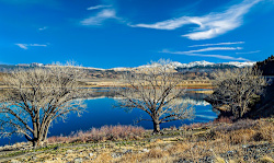
 This is the location of Douglas County from Stateline in Lake Tahoe South.
We are again dealing with extreme snow melt because of rising summer temperatures which is creating flooding events during this time in various parts of the Sierras because of 190% to 230% normal snowfall this year. So, if you are traveling in this vicinity expect almost anything during this time from mudslides to flooding to Flash floods especially if you are along the desert Eastern part next to the High Sierra Mountains.
- Douglas County is a county located in the northwestern part of the U.S. state of Nevada. As of the 2010 census, the population was 46,997. Its county seat is ...
Web results:
- Douglas County government, services, and programs.
- Assessor Learn about the roles and responsibilities assumed by...
- Recorder The Recorder's Office records all documents relating to...
- Contact Us Douglas County Courthouse 1616 8th St. Minden, NV ......
- Job Opportunities Job Opportunities Welcome to the Douglas County...
- Agendas & Minutes Agenda Center To view the Board of County...
- Maps & GIS Who We Are Douglas County GIS is one part of the GIS &...
- Assessor Learn about the roles and responsibilities assumed by...

Douglas CountyAlpine County, California same thing:
- Alpine County, officially the County of Alpine, is a county in the U.S. state of California. As of the 2010 census, the population was 1,175. making it ...
Alpine County, California
From Wikipedia, the free encyclopedia
Alpine County, officially the County of Alpine, is a county in the U.S. state of California. As of the 2010 census, the population was 1,175.[4] making it California's least populous county. The county seat is the Census Designated Place of Markleeville.[5] There are no incorporated cities in the county.Alpine County, California County County of Alpine 
A road sign denoting the Alpine County line along California State Route 89 during a snowstorm in May 2008.
Flag
Seal
Location in the state of California
California's location in the United StatesCountry  United States of America
State  California
Region Sierra Nevada Incorporated March 16, 1864[1] County seat Markleeville Largest community Markleeville Area • Total 743 sq mi (1,920 km2) • Land 738 sq mi (1,910 km2) • Water 4.8 sq mi (12 km2) Highest elevation[2] 11,464 ft (3,494 m) Population (April 1, 2010)[3] • Total 1,175 • Estimate (2016)[3] 1,071 • Density 1.6/sq mi (0.61/km2) Time zone Pacific Standard Time (UTC-8) • Summer (DST) Pacific Daylight Time (UTC-7) Area codes 209, 530 FIPS code 06-003 GNIS feature ID 1675840 Website www .alpinecountyca .gov
Alpine County is in the Sierra Nevada, between Lake Tahoe and Yosemite National Park.
Contents
History
Alpine County was created on March 16, 1864, during a silver boom in the wake of the nearby Comstock Lode discovery.[1] It was named because of its resemblance to the Swiss Alps.[6] The County was formed from parts of Amador, Calaveras, El Dorado, Mono and Tuolumne Counties.[1] At its formation, the County had a population of about 11,000 with its County Seat at Silver Mountain City. By 1868, however, the local silver mines had proven unfruitful; and the population fell to about 1,200. The County Seat was moved to Markleeville in 1875.[1]County Courthouse (1928) in Markleeville
Architect: Frederic J. DeLongchamp
After the silver rush, Alpine County's economy consisted almost entirely of farming, ranching, and logging. By the 1920s, the population had fallen to just 200 people. With the construction of the Bear Valley and Kirkwood ski resorts in the late 1960s, the population increased to the present level.
Geography
According to the U.S. Census Bureau, the county has an area of 743 square miles (1,920 km2), of which 738 square miles (1,910 km2) is land and 4.8 square miles (12 km2) (0.7%) is water.[7] The federal government owns about 96% of Alpine County, the highest percentage in California.[8]
National protected areas
- Eldorado National Forest (part)
- Stanislaus National Forest (part)
- Toiyabe National Forest (part)

No comments:
Post a Comment