To really appreciate this article I would recommend clicking on the word button and title combination at the head of this article two lines down:
begin quote from:
The Midwest Looks Absolutely Drenched in This New Image From Space

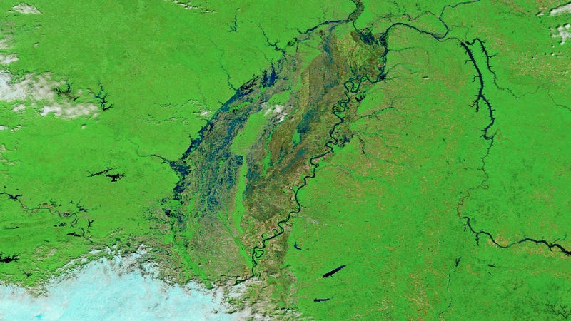
From April 29 to May 1, a volatile weather system spawned heavy rainfall, thunderstorms, and tornadoes across the Midwest. In some areas, total rainfall exceeded 10 to 15 inches, causing flash-floods and surging rivers. Extensive damage has been reported in Texas, Arkansas, Missouri, Mississippi, Alabama, and Tennessee. The floods have resulted in the closure of major waterways and hundreds of roads across several states. According to the Weather Network, at least 20 people have been killed in the Midwest since flooding began late last month.

All of this water is moving downstream, threatening areas along the Mississippi River south of St. Louis, including Cape Girardeau, Missouri, and Illinois. Flood waters could reach as high as 48 feet (15 meters) at Cape Girardeau by Saturday, which would be a new record. Adding insult to injury, the forecast is calling for more rain.
These floods are the worst in the US Midwest since 2015, and are likely the result of a persistent weather trend that’s bringing warm, moist air up from the Gulf Coast—the same trend that’s causing an inordinate number of tornadoes this year.
No comments:
Post a Comment