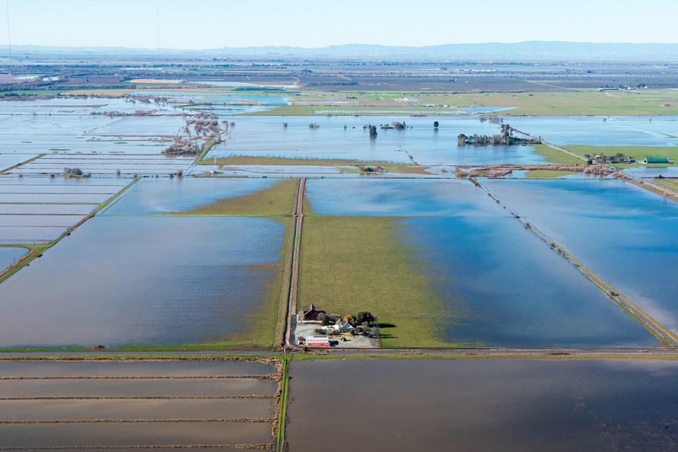
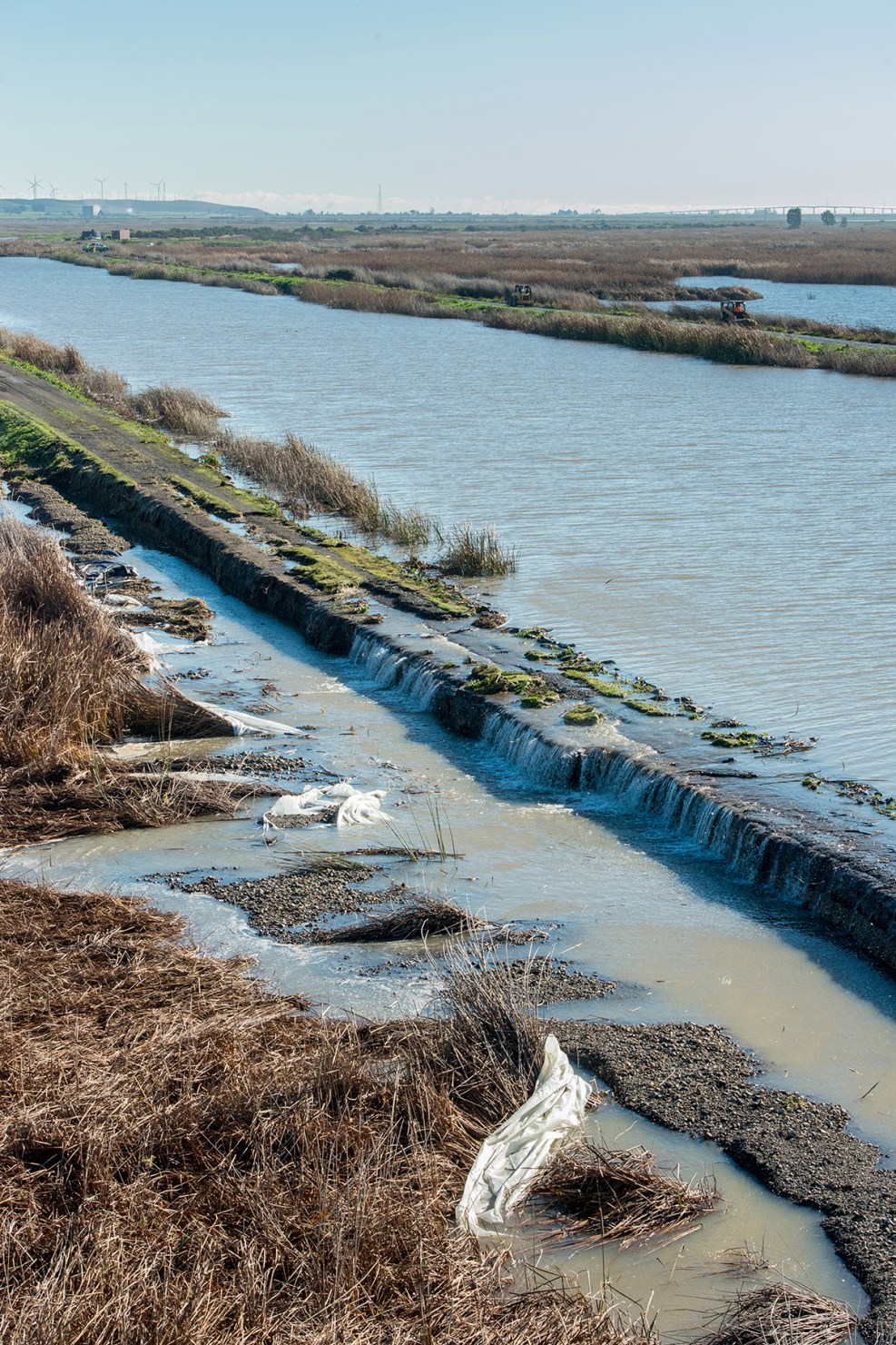
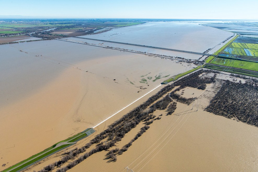
As I was going through Interstate 5 near Sacramento I noticed rice fields under a long bridge span of many miles nearby on 5 that were completely flooded for miles. However, as I looked to my right I saw the water coming into the area that looked like rapids which I had never seen before in any flooding year like this one before so I was surprised. As I listened to the radio they said they were worried about a heat wave melting the snow too fast especially on the eastern Sierras that feed towards Nevada I believe from the California Sierras. So, I was looking for this as it is supposed to be 82 here in Mt. Shasta tomorrow. However, nothing came up. But, this came up which are pretty spectacular photos of what happened in February in mostly Northern California flooding.
begin quote from:
Aerial Photos of California's Winter 2017 Floods, Storm ...
www.nbclosangeles.com/multimedia/Aerial-Photos...Winter storms unleashed days of downpours on California. These aerial images show the extent of the flooding ... Aerial Photos of California's Winter 2017 Floods, ...Aerial Photos of California's Winter 2017 Floods, Storm Damage
By Jonathan Lloyd
Tuesday, Mar 7, 2017
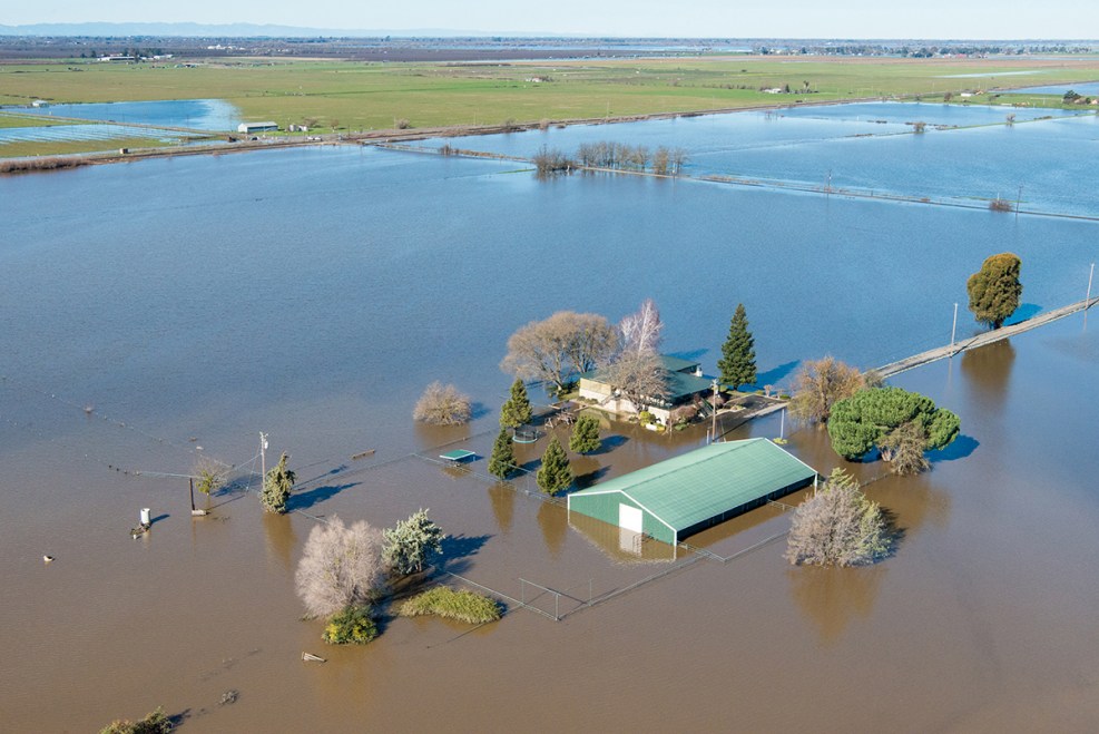
Winter storms unleashed days of downpours on California. These aerial images show the extent of the flooding and effects of the unrelenting winter storms throughout the state, including San Jose, where 14,000 people were evacuated after neighborhoods were inundated with water. Several more weeks remain in California's wet season, which brings the potential for more damage.Kelly M. Grow/ California Department of Water ResourcesFeather and Yuba Rivers Confluence
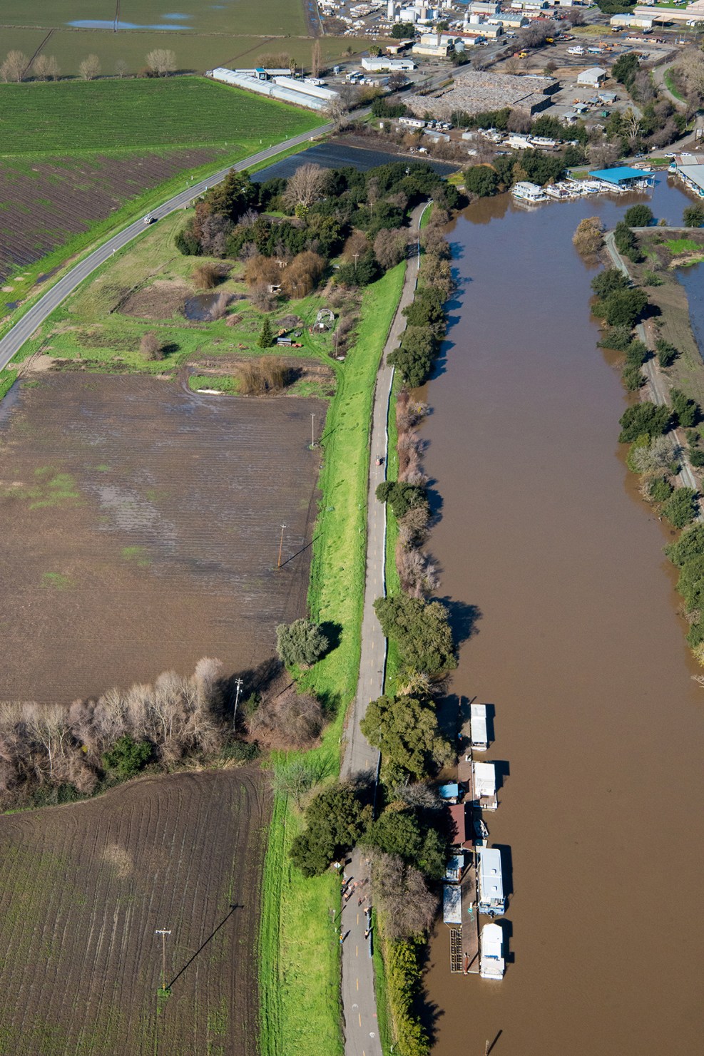
1/24This aerial view looks north toward the confluence of the Feather and Yuba Rivers just south of Marysville, California on the border of Sutter County on the left, and Yuba County on the right. Record rainfall and snow has caused high water levels along the rivers. Photo taken February 26, 2017.Kelly M. Grow/ California Department of Water ResourcesFeather and Yuba Rivers Confluence
2/24An aerial view looking northwest toward the Thermalito Afterbay part of the California State Water Project, background, and the Feather River, about six miles downstream from Oroville, California in Butte County. Record rainfall and snow has caused high water levels in the river. Photo taken February 26, 2017.AFP/Getty ImagesFloodwaters in San Jose
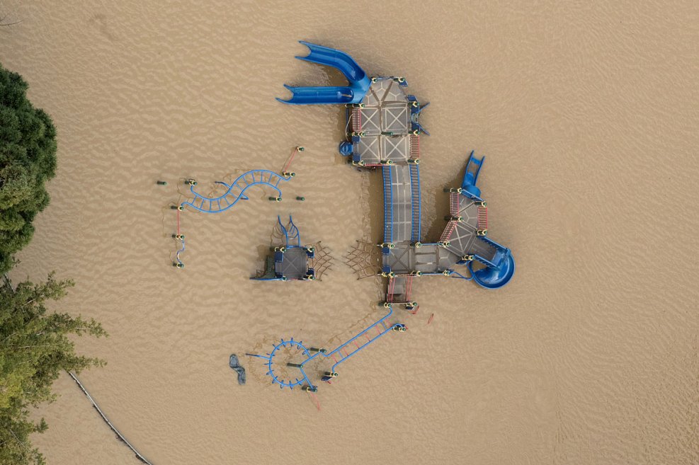
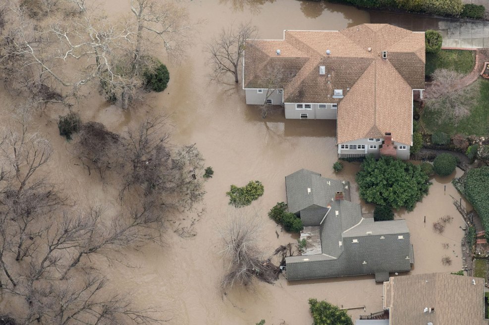
3/24Floodwaters surround a play structure on February 22, 2017, in San Jose, California. Thousands of people were ordered to evacuate their homes in the northern California city as floodwaters inundated neighborhoods and forced the shutdown of a major highway.Florence Low / California Department of Water ResourcesCosumnes River
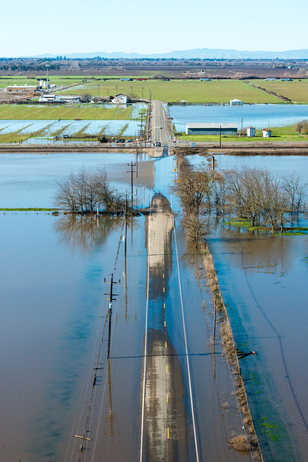
4/24After the recent storms, the Cosumnes River has flooded the area around Twin Cities Road, east of Interstate 5 in Elk Grove, Calif. on January 13, 2017.NBC BAY AREASan Jose Flooding
5/24Floodwaters surround cars Feb. 22, 2017 in San Jose, California.Getty ImagesOroville Dam
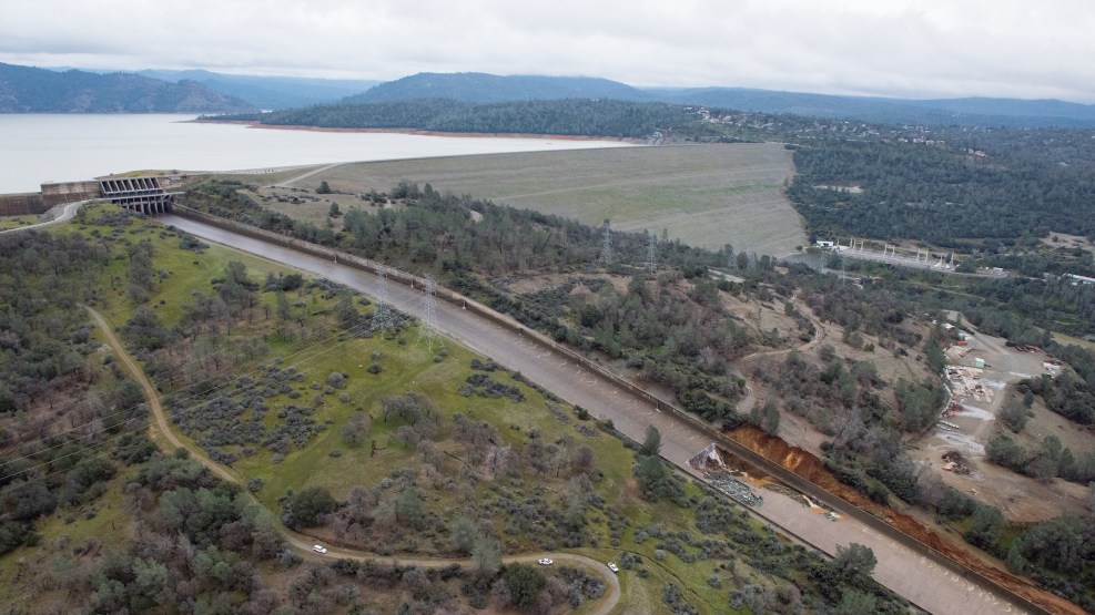
6/24Oroville Lake, the emergency spillway and a damaged main spillway are seen from the air on February 13, 2017 in Oroville, California. Almost 200,000 people were ordered to evacuate the northern California town after a hole in the emergency spillway in the Oroville Dam threatened to flood the surrounding area. (Photo by Elijah Nouvelage/Getty Images)Kelly M. Grow/ California Department of Water ResourcesOroville Dam Spillway Damage
7/24The California Department of Water Resources suspended flows from the Oroville Dam spillway after a concrete section eroded on the middle section of the spillway. Photo taken February 7, 2017.NBC Bay AreaStranded Horses
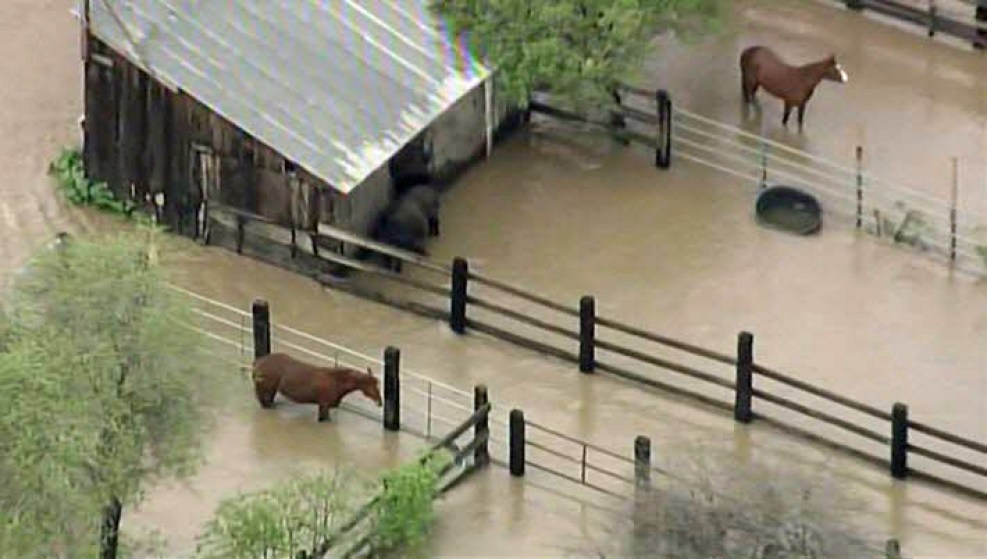
8/24Horses are stranded in San Jose floodwaters Feb. 22, 2017.AFP/Getty ImagesSan Jose Flooding
9/24Floodwaters surround a home on February 22, 2017, in San Jose, California. Thousands of people were ordered to evacuate their homes early Wednesday in the northern California city of San Jose as floodwaters inundated neighborhoods and forced the shutdown of a major highway. / AFP / NOAH BERGER (Photo credit should read NOAH BERGER/AFP/Getty Images)KNBC-TVStudio City Sinkhole
10/24Laurel Canyon Boulevard was partially back open to traffic Monday, Feb. 20, 2017, after a sinkhole opened up and swallowed two cars during a monster storm three days earlier. No serious injuries were reported.Florence Low / California Department of Water ResourcesRising Waters in Solano County
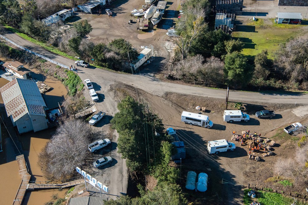
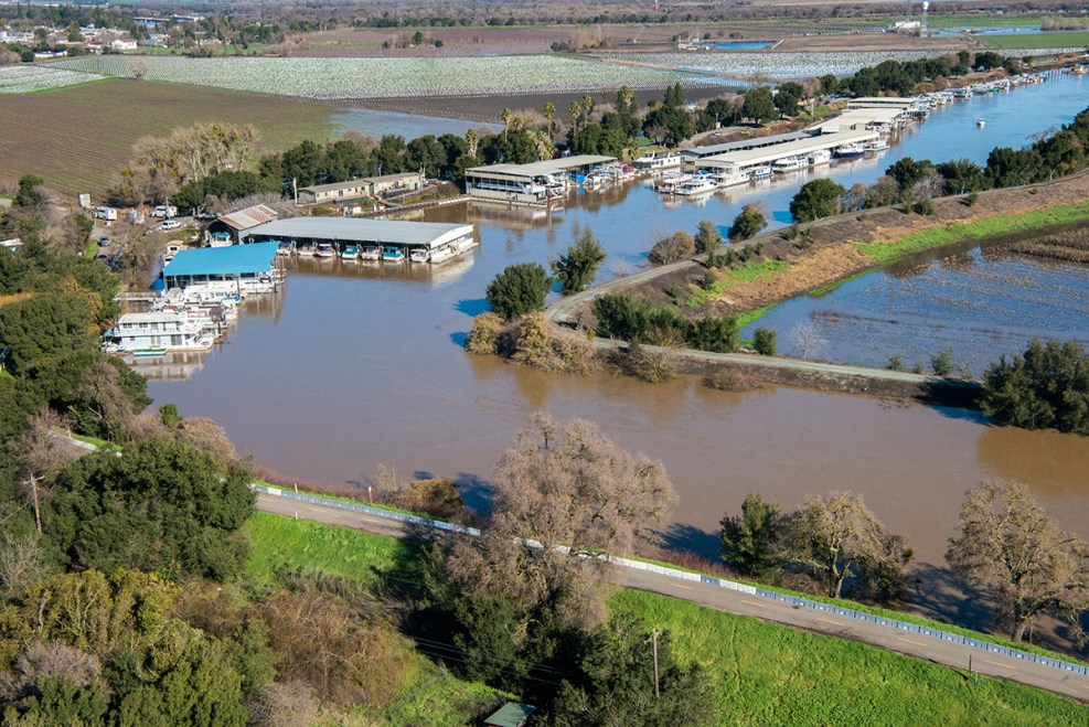
11/24California Department of Water Resources staff employ overtop protection on the levees at Grizzly Island in Solano County, Calif, January 13, 2017.Florence Low / California Department of Water ResourcesSacramento San-Joaquin Delta
12/24Flooding is occurring at both Grizzly Island on the left, and Wheeler Island on the right, located in the Sacramento San-Joaquin Delta in California, January 13, 2017.Florence Low / California Department of Water ResourcesWalnut Grove
13/24Reclamation District 563 builds a muscle wall on the levee for overtop protection along Tyler Island near Walnut Grove, Calif. January 13, 2017.California Department of Water RSandbags in Place at Tyler Island, Sacramento County
14/24At right, Sacramento County Sheriff crews fill sandbags at Tyler Island, located in Sacramento-San Joaquin Delta in California, January 13, 2017. Florence Low / California Department of Water ResourcesCalifornia Department of Water RLevee Protection Near Tyler Island, Sacramento County
15/24Reclamation District 563 builds a muscle wall on the levee for overtop protection along Tyler Island near Walnut Grove, Calif. January 13, 2017. Florence Low / California Department of Water ResourcesFlorence Low / California Department of Water ResourcesFremont Weir Wildlife Area
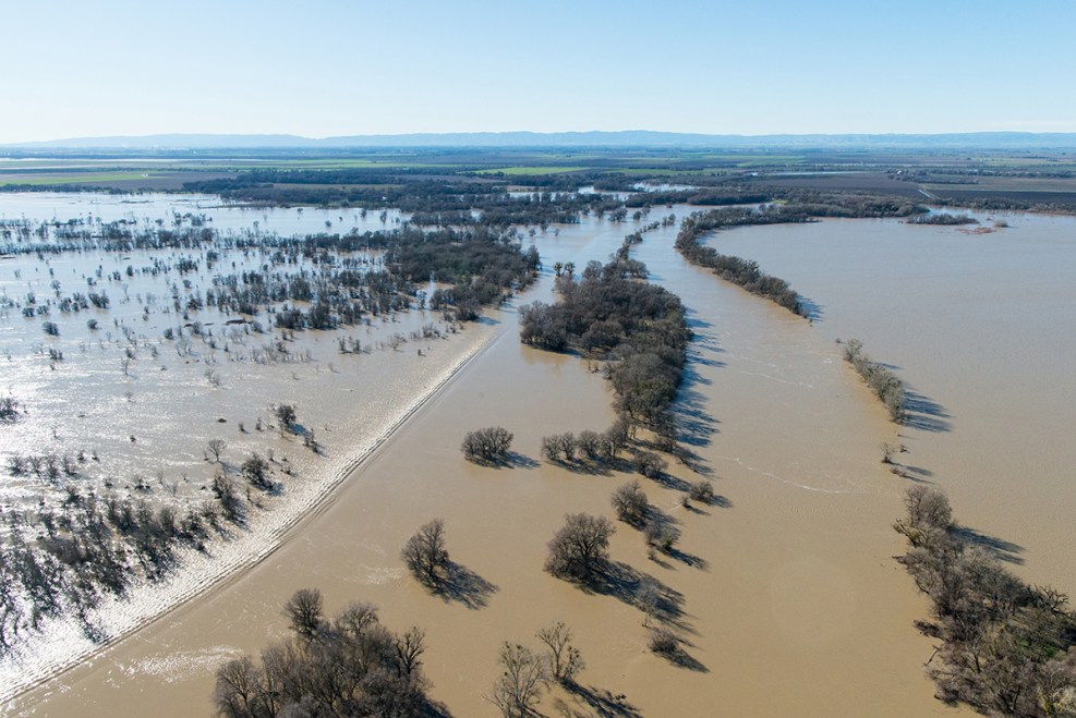
16/24Due to recent storms, Fremont Weir in Knights Landing, Calif. is overtopping, January 13, 2017. The Fremont Weir Wildlife Area is 1,461 acres at the north end of the Yolo Bypass floodway along the Sacramento River in Sutter and Yolo counties.Florence Low / California Department of Water ResourcesFolsom Lake Water Release
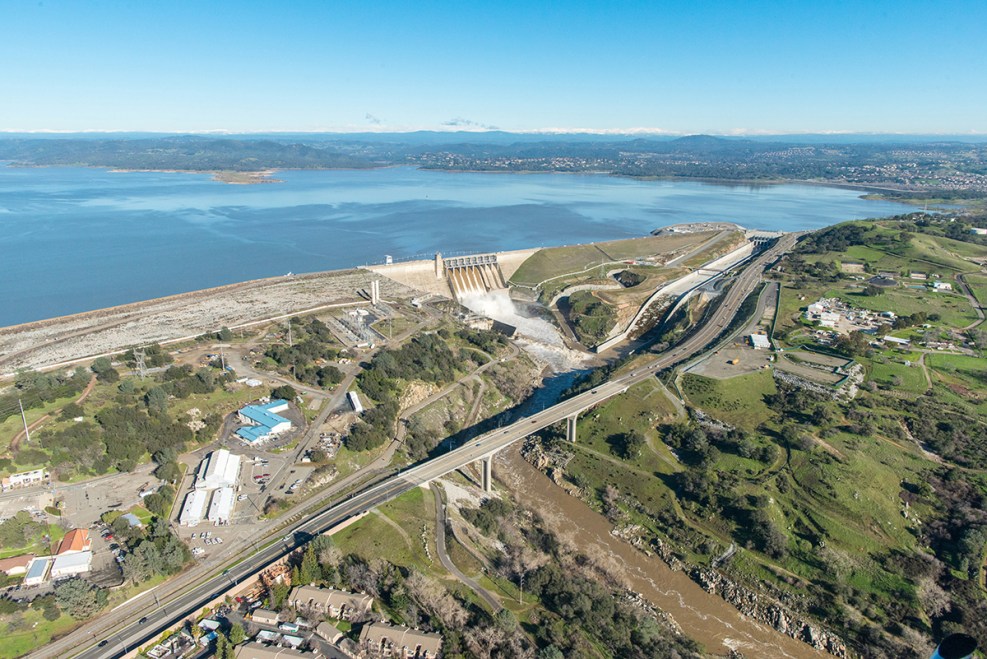
17/24Water is released from Folsom Lake and Dam in Sacramento County as a precaution against flooding, January 13, 2017. The lake's water storage is being reduced to save room for coming storms and snowmelt.Florence Low / California Department of Water ResourcesElk Grove Flood
18/24Recent storms flood a building in Elk Grove, California, on January 13, 2017.Florence Low / California Department of Water ResourcesSubmerged During the Flood
19/24A white vehicle is submerged during a flood on Twin Cities Road in Elk Grove, California, due to recent storms, January 13, 2017.Florence Low / California Department of Water ResourcesCosumnes River
20/24After the recent storms, the Cosumnes River has flooded Twin Cities Road, east of Interstate 5 in Elk Grove, Calif. on January 13, 2017.Florence Low / California Department of Water ResourcesCache Creek Settling Basin
21/24Cache Creek Settling Basin Weir in Yolo County near Woodland, Calif. Jan. 13, 2017. The Cache Creek Settling Basin is located east of Woodland, near where Cache Creek flows into the Yolo Bypass.Florence Low / California Department of Water ResourcesLake Natoma at Nimbus Dam
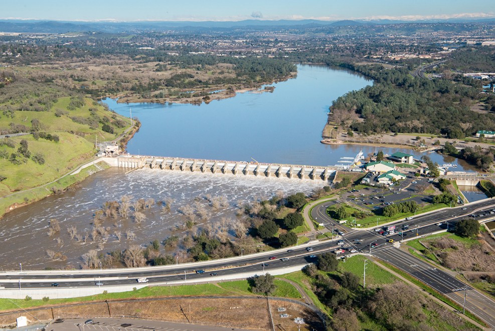
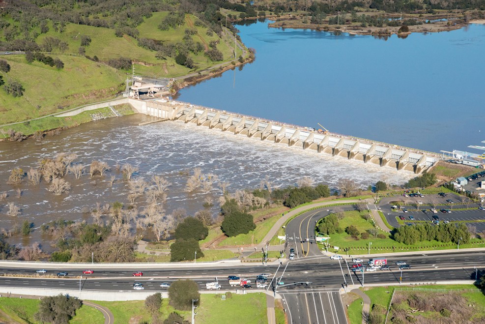
22/24Water is released from Lake Natoma at Nimbus Dam in Rancho Cordova, Calif., as a precaution against flooding, January 13, 2017. Lake Natoma's water storage is being reduced to save room for coming storms and snowmelt. Lake Natoma is an intermediate lake along the American River, located between Folsom Dam and Nimbus Dam in Sacramento County, Calif. The lake is located within the Folsom Lake State Recreation Area.Florence Low / California Department of Water ResourcesLake Natoma at Nimbus Dam
23/24Water is released from Lake Natoma at Nimbus Dam in Rancho Cordova, Calif., as a precaution against flooding, January 13, 2017. Lake Natoma's water storage is being reduced to save room for coming storms and snowmelt. Lake Natoma is an intermediate lake along the American River, located between Folsom Dam and Nimbus Dam in Sacramento County, Calif. The lake is located within the Folsom Lake State Recreation Area.NASAAtmospheric River From Space
24/24For a view of the reason behind the storms, we offer and even higher perspective This NASA satellite imagery shows the weather pattern that is responsible for this winter's steady stream of storms -- an atmospheric river. The systems draw moisture up from the tropics, unleashing a series of storms on the West Coast.
To the best of my ability I write about my experience of the Universe Past, Present and Future
Top 10 Posts This Month
- 158,008 visits to intuitivefred888
- This is what the code looks like displayed on a page
- Went up into the snow today on Mt. Shasta
- Fulll Article: Iran war's shock waves threaten England's farms 6,000 miles away
- The reliant robin 3 wheeled CAR?
- California bear-suit luxury car scam ends in insurance fraud sentences for 3
- The problem with Social Media might be different than you think?
- Why scientists are nervous about fungi: Full Article
- Full Article: Desperate for fuel, US allies in Asia are turning to its adversaries instead
- ABC News: Historians sue over Trump's attempt to ignore Presidential Records Act
Subscribe to:
Post Comments (Atom)








No comments:
Post a Comment